
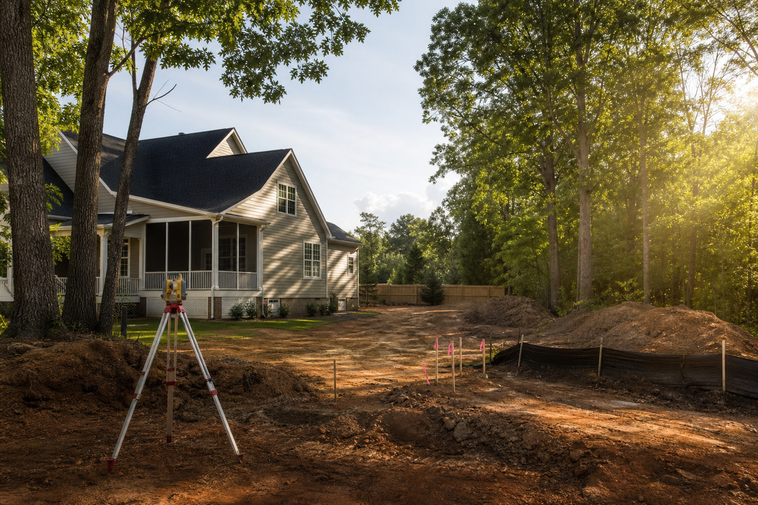
Before locating a detached garage, workshop, or similar accessory structure, an owner should confirm the main site constraints first: zoning district and setback rules, easements and utility locations, access and drainage patterns, tree and vegetation limits, and how the placement will affect future flexibility on the lot. These main site constraints usually determine where a structure can legally and practically sit long before any design details are finalized.
This article summarizes publicly available information from York County, South Carolina and the City of Charlotte as a starting point for owner awareness. It does not replace a site-specific review by the applicable zoning office, building department, surveyor, or other qualified professional. Zoning classifications, setback tables, easement records, and review procedures can change, and they vary by parcel. Anyone planning an accessory structure should verify current requirements directly with the authority having jurisdiction before finalizing a site plan.
What Current Public Sources Establish
York County, South Carolina maintains a Zoning page and a set of Land Use Codes that describe how properties are classified and what general standards apply within each zoning district. These published resources are a useful starting point for understanding how a parcel is categorized, but they are general references rather than a substitute for a parcel-specific determination. Zoning districts commonly address use type, setbacks, height, and lot coverage, and accessory structures are often treated differently than a primary residence within the same district.
The City of Charlotte separately publishes information on Individual Residential Lot Reviews, which describes a process for reviewing site-specific conditions on a residential lot as part of getting a project started. This kind of lot-level review process exists because general zoning rules do not always capture everything unique to an individual property, such as easements, floodplain considerations, or existing site conditions. Because these published resources describe general processes and standards rather than a specific property's status, any application of these rules to a real project should be verified directly with the applicable local zoning or planning office before a site plan is finalized.
It is also worth noting that jurisdictions update zoning codes and review procedures over time, and the specific department or process that applies can depend on whether the property is inside city limits, in unincorporated county area, or in a jurisdiction with its own separate rules. An owner should not assume that requirements described for one jurisdiction automatically apply to a different city or county nearby.
- York County publishes a Zoning page describing zoning districts and related standards.
- York County also publishes Land Use Codes as a separate reference for understanding property classifications.
- The City of Charlotte describes an Individual Residential Lot Review process for site-specific project starts.
- Requirements can differ significantly between incorporated cities and unincorporated county areas.
- Published information should be confirmed with the applicable authority before finalizing plans.
Inputs and Existing Conditions to Document
Good accessory structure site planning starts with documenting what already exists on the property, not with picking a location and working backward. A current survey or plat is one of the most useful documents an owner can gather, since it typically shows property lines, recorded easements, and sometimes existing utility corridors. Without this documentation, it is easy to assume open yard space is available for a structure when it is actually encumbered by an easement or setback requirement that limits what can be built there.
Beyond the survey, an owner should also gather information about existing utility lines, septic or well locations if applicable, drainage patterns across the lot, and any trees or vegetation that may be subject to local protection rules. Slope and grading conditions matter as well, since a location that looks flat to the eye may still direct water toward a neighboring property or toward the main house foundation once a structure and its roof runoff are added.
Taken together, this documentation forms the factual basis for a site planning planning conversation with the project team and the applicable authority. Skipping this step tends to push problems later into the process, when they are more disruptive and more costly to resolve.
- A current survey or plat showing property lines and recorded easements.
- Known utility line locations, including any private utility locate requests already completed.
- Septic system or well locations if the property relies on either.
- Drainage patterns and low points across the yard.
- Existing trees, wooded areas, or vegetation subject to local protection standards.
A Site-Fit Decision Tree: Use, Zoning, and Setbacks
One practical way to approach accessory structure site planning is to work through a simple decision tree rather than jumping straight to a preferred spot in the yard. The first branch is use: is the structure intended as a garage, a workshop, a storage building, or something with a different function, since intended use can affect which zoning standards apply and whether additional review steps are triggered. Clarifying the intended use early helps avoid a mismatch between what is planned and what the applicable zoning district actually allows for accessory structures.
The second branch is zoning and setbacks. Once the zoning district for the parcel is confirmed through the applicable local source, an owner can look at what setback distances apply from front, side, and rear property lines, and whether accessory structures have different setback rules than the primary residence. Lot coverage limits and maximum structure size or height may also apply and should be checked at this stage rather than after a structure has already been designed.
Working through use and zoning first narrows the buildable area on paper before any physical work happens on site. This sequence matters because a structure that fits comfortably from a design standpoint can still fail to meet setback or use requirements if zoning is not checked early in accessory structure site planning.
- Confirm the intended use of the structure, such as garage, workshop, or storage.
- Identify the zoning district that applies to the parcel through the applicable local zoning office.
- Check setback requirements for front, side, and rear property lines for accessory structures specifically.
- Review lot coverage, height, and size limits that may apply within the zoning district.
- Confirm whether accessory structure standards differ from those applied to the primary residence.
A Site-Fit Decision Tree: Utilities, Access, and Drainage
After use and zoning are addressed, the next branches in the decision tree involve utilities, access, and drainage, since these three factors often interact with each other on a real lot. Utility easements can restrict where a structure may be placed even within an otherwise buildable setback area, and utility lines themselves, whether overhead or underground, may need to be located before any excavation or foundation work begins. An owner should ask the applicable utility providers or a locating service about existing lines before treating any part of the yard as fully open space.
Access is the next consideration, particularly for a detached garage or workshop that will require vehicle or equipment access. A location that satisfies setback rules but sits behind existing landscaping, a steep grade change, or a narrow side yard may create a structure that is difficult to use as intended. Drainage should be reviewed alongside access, since adding a roof and any paved surface changes how water moves across a lot, and a location near a low point or natural drainage path can create water management issues for the new structure or for neighboring properties.
These three factors are easy to treat as separate afterthoughts, but they are more effectively addressed together during the same site walk, since a change made to solve one issue, such as regrading for drainage, can affect access or utility clearance in the same area.
- Confirm the presence and location of recorded utility easements before selecting a final structure location.
- Request utility locates for underground lines before any excavation work is planned.
- Evaluate realistic vehicle or equipment access to the proposed structure location.
- Review existing drainage patterns and how added roof and surface area will change water flow.
- Consider how grading changes made for one purpose, such as drainage, may affect access or utility clearance.
A Site-Fit Decision Tree: Trees and Future Flexibility
Trees and vegetation are often the most visible existing condition on a lot, but they are frequently addressed too late in the planning process. Some jurisdictions have specific rules about tree removal, protected species, or root zone protection near construction activity, so an owner should ask the applicable local authority whether any such rules apply to the property before removing trees to make room for a structure. Even where no specific rule applies, root systems near a proposed foundation can affect long-term structure stability and should be considered during site selection.
The final branch in the decision tree is future flexibility, which is often overlooked because it does not create an immediate obstacle. An owner should think about how the chosen location might affect future additions to the main house, future subdivision or use changes on the lot, or future utility work, such as a septic system expansion or a new utility connection. Placing an accessory structure in a location that technically meets today's setback and zoning rules but blocks a reasonable future improvement can create avoidable limitations later.
Considering future flexibility does not mean designing for every hypothetical scenario, but it does mean pausing to ask whether the chosen location leaves reasonable room for known or likely future changes to the property.
- Ask the applicable local authority whether tree removal or protection rules apply to the property.
- Consider root systems near a proposed foundation area even where no specific rule applies.
- Evaluate whether the chosen location could interfere with a future addition to the main house.
- Consider future utility needs, such as septic expansion or new utility connections.
- Avoid placing a structure in a way that closes off reasonable future flexibility on the lot.
Step-by-Step Owner and Project-Team Review
Bringing the decision tree together into a practical sequence can help an owner and the project team stay organized during accessory structure site planning. The review generally starts with gathering documentation, moves through zoning and setback confirmation, and then works through utilities, access, drainage, trees, and future flexibility before a final location is selected. Treating this as a sequence rather than a single conversation helps ensure that no factor is skipped simply because an earlier step took priority.
Throughout this process, it is important to keep a written record of what has been confirmed and by whom, whether that is a zoning confirmation from the local planning office, a utility locate request number, or a surveyor's notes about an easement. This record becomes useful if questions arise later in the project, and it also helps the project team communicate clearly with each other about what has already been verified versus what still needs confirmation.
An owner working through this checklist does not need to become a zoning expert, but having a clear sequence makes it easier to ask informed questions of the applicable authority and any professionals involved in the project.
- Gather a current survey, existing utility information, and any known easement documentation.
- Confirm the zoning district and applicable setback rules with the local zoning or planning office.
- Request utility locates and review access routes to the proposed structure area.
- Walk the site to evaluate drainage patterns and existing trees near the proposed location.
- Discuss future flexibility considerations with the project team before finalizing the site plan.
- Keep written records of confirmations from the applicable authority and any professionals consulted.
Responsibilities, Dependencies, and Hold Points
Accessory structure site planning involves multiple parties, and it helps to be clear about who is responsible for which piece of information. The applicable zoning or planning office is responsible for confirming zoning district classification, setback requirements, and any required review steps for accessory structures. A licensed surveyor is typically the appropriate resource for confirming property lines and recorded easements, while utility providers or a locating service confirm underground or overhead utility locations relevant to the property.
There are natural hold points in this process where an owner should pause before moving forward. Confirming zoning and setback requirements is one hold point, since design decisions made before this confirmation may need to be revised. Completing utility locates is another hold point, particularly before any excavation or grading work begins. Treating these as checkpoints rather than optional steps helps prevent a structure from being sited in a way that creates conflicts with easements, utilities, or zoning requirements discovered later.
Because these responsibilities are split across several parties, clear communication between the owner, the project team, and the applicable authority is important throughout the process, especially when a question falls into a gray area that is not clearly addressed by publicly available information alone.
- The applicable zoning or planning office confirms zoning district and setback requirements.
- A licensed surveyor confirms property lines and recorded easement locations.
- Utility providers or a locating service confirm underground or overhead utility positions.
- Zoning and setback confirmation is a hold point before finalizing structure design.
- Utility locate completion is a hold point before excavation or grading begins.
Common Coordination Failures
A number of coordination failures tend to repeat across accessory structure projects, and most of them trace back to skipping one of the steps described above. One common failure is selecting a structure location based on visual open space in the yard without checking a current survey, which can lead to a structure being proposed within a recorded easement or too close to a property line. Another common failure is confirming general zoning district information without checking whether accessory structures have different setback or size rules than the main house within that same district.
Drainage-related coordination failures are also common, particularly when a structure location is chosen without walking the site during or after rain, or without asking how added roof runoff will be managed. Similarly, tree-related conflicts often arise when removal work begins before confirming whether any local tree protection rules apply, which can create delays or complications that were avoidable with an earlier question to the applicable authority.
Many of these failures are not the result of an owner or contractor ignoring the rules, but of moving through the planning process in the wrong order, such as finalizing a design before confirming zoning, or scheduling excavation before utility locates are complete. Following the sequence described in the earlier sections is one practical way to reduce the chance of these coordination failures happening on a real project.
- Choosing a location based on visible open space without checking a current survey for easements.
- Assuming accessory structure setbacks match the main house setbacks within the same zoning district.
- Selecting a site without observing how the area drains during or after rainfall.
- Beginning tree removal before confirming whether local tree protection rules apply.
- Scheduling excavation before utility locate requests have been completed.
Questions homeowners ask
What is the first thing to check before placing a detached garage or workshop?
Start with the zoning district that applies to the parcel and the setback and lot coverage rules tied to that district. York County publishes zoning information and land use codes that describe how districts are defined, and similar information is typically available for other jurisdictions in the region. Before assuming a location works, confirm the zoning classification and any overlay districts with the applicable planning or zoning office, since these rules directly affect where an accessory structure can be located on the lot.
Do accessory structures need a separate review from the main house?
In many jurisdictions, accessory structures go through their own review steps even when a home already exists on the lot. The City of Charlotte, for example, describes individual residential lot review processes that address site-specific conditions. Because review steps, submittal expectations, and applicable codes can differ by structure type and by jurisdiction, an owner should ask the local building or planning department what specifically applies to a detached garage, workshop, or similar structure on their property.
What existing conditions are most often overlooked during accessory structure site planning?
Utility easements, drainage paths, and tree protection areas are commonly overlooked because they are not always visible from a simple walk around the yard. A recorded plat or survey often shows easements and utility corridors that are not obvious on the surface, and some jurisdictions also regulate tree removal or protected root zones. Reviewing a current survey and asking the local authority about easement and environmental restrictions early can prevent a conflict after a structure location has already been chosen.
Who should be involved in reviewing the site before construction begins?
Depending on the property and the scope of the accessory structure, this can include the local zoning or planning office, a licensed surveyor, a utility locator service, and in some cases an engineer or other qualified professional. CDG Carolinas can help owners organize the practical planning questions and coordinate with the project team, but code interpretation, easement determinations, and environmental questions should be confirmed with the responsible authority or licensed professional for the property.
Plan the next step
Use this article as a planning aid, then confirm project-specific requirements with the responsible authority and qualified professionals. Review CDG's related service, construction articles, or consultation page when you are ready to organize the next decision.
Official sources and verification
- York County, South Carolina: Zoning
- York County, South Carolina: York County Land Use Codes
- City of Charlotte: Individual Residential Lot Reviews
Authority pages, forms, fees, review steps, and code references can change. Verify the current path for the property and scope before relying on a planning assumption.