
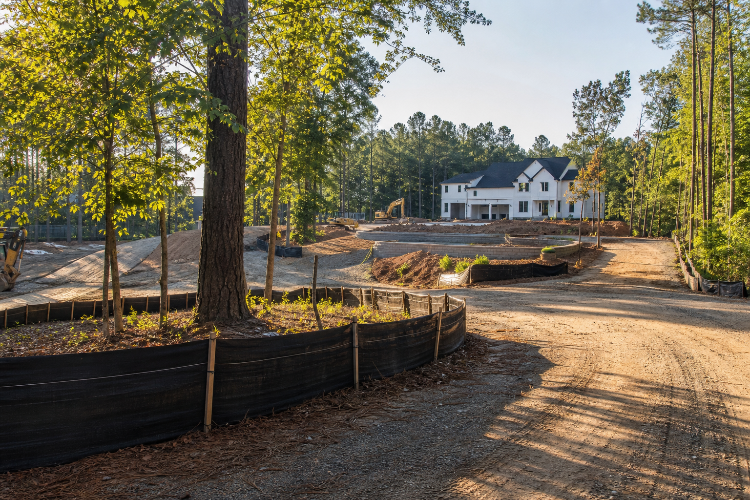
Temporary construction access, most often called a construction entrance, deserves testing before permanent driveways, retaining walls, drainage swales, or landscaping are locked into a site plan because the access route carries every truck, delivery, and piece of equipment that will touch the property during building. If that route is drawn only on paper and never checked against the real grade, sight distance, tree canopy, and drainage pattern on the lot, the finished site plan can lock in conflicts that are expensive and disruptive to fix once construction has already started.
This article explains why owners and project teams benefit from treating construction entrance placement as its own logistics review rather than an afterthought attached to the final site plan. It draws on published guidance from the City of Charlotte and York County, South Carolina, but it is general educational information, not a substitute for a site-specific review. Zoning, stormwater, driveway permit, and erosion control requirements vary by jurisdiction and by lot, and they can change after this article is published, so any property-specific decision should be verified directly with the local authority having jurisdiction and, where appropriate, a licensed design professional.
What Current Public Sources Establish
The City of Charlotte's guidance on Individual Residential Lot Reviews describes a process for evaluating a residential lot before and during construction, including how the city looks at site conditions relative to the proposed work. This kind of lot-level review is a reminder that a residential parcel is assessed as a whole system, not simply as a footprint for a house. Access, grading, and drainage on a given lot are part of what a jurisdiction may consider during its review process, so early attention to how a construction entrance interacts with those factors is consistent with how municipalities approach residential lot review generally.
York County, South Carolina's Construction Site Runoff Control page addresses stormwater and erosion control expectations tied to construction activity. Runoff control measures are directly connected to how a site is disturbed, including where vehicles enter and exit, where soil is exposed, and how water is directed during construction. Neither source provides a universal checklist for construction entrance placement, and neither substitutes for a jurisdiction-specific determination. They do establish that lot-level review and runoff control are recognized regulatory concerns in these communities, and that any construction access plan should be developed with those concerns in mind and verified against current local requirements before work begins.
- The City of Charlotte reviews individual residential lots through its Individual Residential Lot Reviews process, which owners can read about on the city's website.
- York County, South Carolina maintains published guidance on Construction Site Runoff Control that addresses stormwater and erosion expectations tied to construction activity.
- Neither source is a substitute for a current, project-specific determination from the authority having jurisdiction over a given lot.
Why Construction Entrance Placement Affects the Whole Site Plan
A construction entrance is not a minor detail tucked into the corner of a site plan. It is the single point where all delivery trucks, concrete trucks, equipment trailers, and worker vehicles will cross the property line during the entire build. If that crossing point is chosen without checking sight distance along the adjacent road, grade transitions on the lot, existing tree locations, and natural drainage paths, the entrance can end up in direct conflict with features that were meant to be permanent, such as a finished driveway, a retained tree, or a drainage swale designed to carry water away from a foundation.
This is why construction entrance site planning benefits from being treated as its own logistics overlay early in the process, before permanent site features are drawn as final. A logistics overlay simply means looking at the lot through the lens of how it will actually be used during construction, separate from how it will look when construction is finished. When that overlay is skipped, teams sometimes discover midway through a project that the only practical truck route crosses a tree the owner wanted saved, or that the temporary entrance grade is too steep for loaded trucks once the site is wet, or that stabilization measures required for runoff control were never accounted for in the original layout.
- The construction entrance carries every vehicle and delivery for the life of the project, so its placement has an outsized effect on the rest of the site.
- Testing access before finalizing permanent features can reveal conflicts with sight distance, grade, trees, and drainage while they are still easy to adjust on paper.
- Skipping this step can force late changes to features that were already assumed to be final, which is more disruptive than adjusting a plan early.
Inputs and Existing Conditions to Document
Before a construction entrance location is chosen, it helps to document the existing conditions that will influence whether that location actually works in practice. This is not a design decision made in isolation. It depends on real, measurable conditions on the specific lot, many of which are also relevant to permanent site plan features like the finished driveway, stormwater controls, and landscaping.
Owners and project teams typically want to understand the road frontage and any sight distance concerns where a temporary or permanent entrance would meet the public right of way, the existing grade across the lot and how steep any access route would need to be for loaded construction vehicles, the location of trees the owner intends to keep and how close a travel path would come to their root zones, and the natural low points and drainage paths on the lot that could be disrupted or that could carry sediment offsite if disturbed.
- Road frontage conditions and sight distance at any point where vehicles will enter or exit the property.
- Existing grade and slope across the lot, particularly along any route heavy vehicles would use.
- Locations of trees intended to remain, along with an understanding of root zone sensitivity.
- Natural drainage paths and low points on the lot that could carry runoff during construction.
- Anticipated delivery and equipment types, since a route that works for pickup trucks may not work for concrete trucks or long trailers.
Step-by-Step Owner and Project-Team Review
A practical way to approach construction entrance site planning is to walk through it as a distinct step before the site plan is treated as final, rather than assuming the entrance will simply fit wherever the driveway eventually goes. This does not need to be complicated, but it does benefit from being deliberate and documented rather than left to judgment calls made once equipment is already on site.
A useful sequence starts with reviewing the existing conditions listed above, then sketching one or more candidate access routes on the lot, then checking each candidate against sight distance at the road, grade for loaded vehicles, tree protection needs, and drainage impact. Once a route looks workable on paper, it is worth discussing with the project team how it will be stabilized during use and how it will be restored once construction access is no longer needed, since a temporary route that is never properly stabilized can become a source of erosion and runoff concerns during the project.
- Review documented existing conditions for the lot before selecting a candidate access route.
- Sketch more than one possible entrance location if the lot allows it, so options can be compared.
- Check each candidate against sight distance, grade, tree impact, and drainage before settling on a final route.
- Discuss stabilization measures for the access route while it is in active use during construction.
- Plan for restoration of the temporary access area once it is no longer needed, so the finished site plan is not compromised.
Responsibilities, Dependencies, and Hold Points
Construction entrance planning does not happen in isolation from the rest of the project team. The owner typically has final say over which permanent features matter most, such as specific trees or a preferred driveway alignment, while the design and construction team is responsible for translating those priorities into a workable access plan that also meets site conditions and any applicable local requirements. Civil or drainage professionals, where involved, are typically responsible for confirming how a temporary access route interacts with stormwater and erosion control measures required for the site.
Because these responsibilities overlap, it helps to identify hold points in the process, meaning specific moments where the team pauses to confirm the access plan works before moving forward with grading, tree removal, or permanent driveway installation. A hold point before grading begins can prevent a situation where equipment has already altered the site in a way that makes the originally planned access route impossible or unsafe. Any requirement tied to erosion control, driveway permits, or lot review should be verified with the applicable authority having jurisdiction, since these requirements can vary by municipality and by lot and can change over time.
- Owners typically identify which permanent features, such as specific trees or driveway alignment, matter most to preserve.
- Design and construction teams are typically responsible for translating those priorities into a workable access plan.
- Civil or drainage professionals, where involved, address how temporary access interacts with stormwater and erosion control measures.
- A hold point before grading or tree removal begins can confirm the access plan still works before it becomes difficult to change.
- Local requirements for driveway permits, lot review, or runoff control should be verified with the authority having jurisdiction for the specific property.
Common Coordination Failures
Several recurring patterns show up when construction entrance placement is not tested early. One common failure is choosing an access point based only on where the final driveway is expected to go, without checking whether that location can actually support construction traffic before the driveway itself is built. Another is underestimating grade, since a route that looks fine on a flat drawing may be too steep for loaded trucks once actual slope is measured, especially after rain softens the surface.
Tree impacts are another frequent issue, particularly when a route is planned close to trees an owner wants to keep, without accounting for root zone sensitivity or the width needed for equipment to pass safely. Drainage is often the most costly oversight, since a temporary access route that crosses or blocks a natural drainage path can concentrate runoff in ways that create erosion or sediment problems, which is directly relevant to the kind of construction site runoff control concerns described in York County's published guidance. Finally, restoration is sometimes left unplanned entirely, leaving an owner to discover late in the project that the temporary access area needs additional work before it can become part of the finished landscape.
- Assuming the final driveway location will automatically work as a construction access route without separate testing.
- Underestimating grade steepness for loaded vehicles, particularly under wet conditions.
- Planning a route too close to trees intended for preservation without accounting for root zone impacts.
- Overlooking how a temporary route affects natural drainage paths, which can lead to runoff and erosion issues during construction.
- Failing to plan for stabilization and restoration of the access area once construction is complete.
Questions for the Responsible Authority or Qualified Professional
Because construction entrance requirements and expectations can vary significantly by jurisdiction and by lot, owners and project teams benefit from bringing specific questions to the authority having jurisdiction or to a qualified design professional before finalizing a site plan. These questions are meant to prompt a property-specific conversation, not to replace one.
Useful questions include whether the local jurisdiction has specific requirements or review processes tied to construction access on residential lots, similar to what is described in the City of Charlotte's Individual Residential Lot Reviews information, and what erosion and runoff control measures apply to construction activity on the specific property, similar to the concerns addressed in York County's Construction Site Runoff Control guidance. It is also worth asking whether any driveway or right-of-way permit is needed before a temporary or permanent entrance can be used, and what documentation, if any, the jurisdiction expects regarding stabilization and restoration of a temporary construction access area once it is no longer in use.
- Does the local jurisdiction have a lot review process that addresses construction access, and what does it require for this property?
- What erosion and stormwater runoff control measures apply to construction activity on this specific lot?
- Is a separate permit needed for a temporary construction entrance, or for the eventual permanent driveway?
- What documentation or inspection, if any, is expected for stabilization and restoration of a temporary access route?
- How do local sight distance standards apply to the specific road frontage on this lot?
Next Action and Related CDG Service Resource
Testing construction entrance placement before permanent site features are locked in is one part of a broader site planning process that also considers zoning, grading, drainage, and tree preservation together rather than in isolation. Because these elements interact, it often makes sense to look at construction entrance site planning as one item on a larger site planning planning checklist that gets reviewed with the project team before final design decisions are made.
Owners working through these questions on a specific property can review CDG's site planning service page for Lake Wylie, SC at /site-planning-lake-wylie-sc/ for general information on how site planning fits into a broader project, browse related articles on the CDG blog at /blog/ for more background on zoning and site logistics topics, or reach out through the consultation page at /consultation/ to discuss a specific lot. Any final decision about construction access, drainage, or permitting should still be verified with the applicable authority having jurisdiction, since requirements are specific to each property and can change over time.
- Review CDG's site planning resource for Lake Wylie, SC to see how site planning fits into a broader residential project.
- Browse the CDG blog for additional articles related to lot zoning, site logistics, and related planning topics.
- Use the consultation page to start a conversation about a specific property, keeping in mind that final requirements must be verified with the authority having jurisdiction.
Questions homeowners ask
Why can construction entrance site planning affect features that are supposed to be permanent?
The construction entrance is the only route vehicles and deliveries use for the entire build, so if it is placed without checking grade, sight distance, tree locations, and drainage, it can end up conflicting with a finished driveway, a saved tree, or a planned drainage swale. Testing the entrance location early, before those permanent features are treated as final, gives the project team a chance to adjust the plan while changes are still easy to make.
Do local governments review construction access on residential lots?
Some jurisdictions do consider access and site conditions as part of a broader residential lot review, as described in the City of Charlotte's published Individual Residential Lot Reviews information. Requirements vary by city and county and can change, so it is important to confirm what applies to a specific lot with the local authority having jurisdiction rather than assuming one jurisdiction's process applies elsewhere.
What does construction site runoff control have to do with where the entrance is placed?
A construction entrance changes how vehicles cross a site, which can disturb soil and redirect water if it is not planned around existing drainage paths. York County, South Carolina's published guidance on Construction Site Runoff Control addresses these kinds of erosion and stormwater concerns tied to construction activity, and any project-specific runoff control measures should be verified with the applicable jurisdiction.
Who is responsible for deciding where a construction entrance goes?
Responsibility is typically shared. Owners usually identify which permanent features matter most to protect, such as specific trees, while the design and construction team works out an access route that fits those priorities and site conditions. Where drainage or erosion control is a concern, a civil or drainage professional may also be involved, and any requirement tied to permits or local review should be confirmed with the authority having jurisdiction for the property.
Plan the next step
Use this article as a planning aid, then confirm project-specific requirements with the responsible authority and qualified professionals. Review CDG's related service, construction articles, or consultation page when you are ready to organize the next decision.
Official sources and verification
- City of Charlotte: Individual Residential Lot Reviews
- York County, South Carolina: Construction Site Runoff Control
Authority pages, forms, fees, review steps, and code references can change. Verify the current path for the property and scope before relying on a planning assumption.