
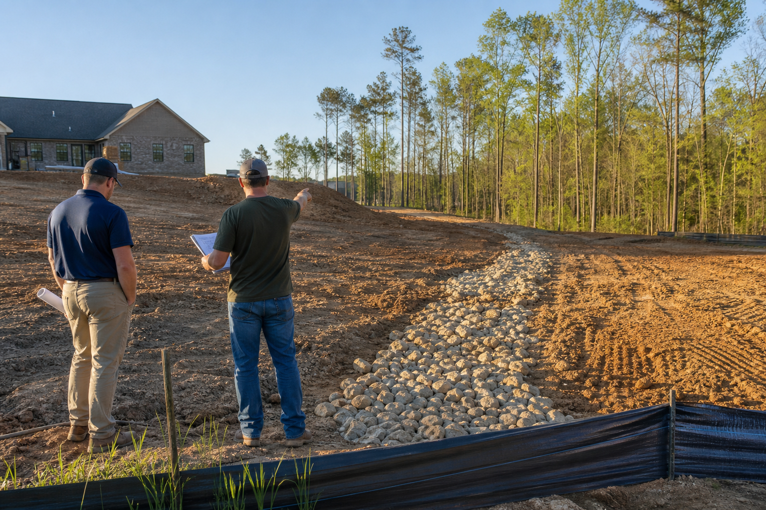
Before grading begins, the owner and project team should walk the full path that water will take once it leaves the building pad, not just the pad itself. That means tracing the natural and constructed drainage route across the property, through adjoining parcels where visible, and toward the nearest defined channel, ditch, storm drain, or water body, while noting existing vegetation, slopes, low points, culverts, and any signs of prior erosion or ponding.
This walkthrough is an observation exercise, not an engineering or legal determination. Documenting what is visible on the ground helps the project team ask better questions and flag issues early, but it does not replace a stormwater plan review, a licensed engineer's analysis, or a determination by the authority having jurisdiction. Requirements referenced in this article come from published sources for York County, South Carolina and the City of Charlotte, North Carolina, and current project-specific requirements must always be verified directly with the applicable jurisdiction before design or grading decisions are finalized.
What Current Public Sources Establish
York County, South Carolina maintains a stormwater plan review process described on its official Stormwater Plan Review page. That page outlines the general framework the county uses to evaluate stormwater management for development activity, and it points applicants toward the specific submittal expectations tied to a given project type or disturbance threshold. Because these expectations can be updated, the published page itself, not a summary, is the correct reference point for anyone preparing a submittal.
The City of Charlotte publishes a parallel set of expectations through its Stormwater Regulations page, which describes the regulatory structure the city applies to stormwater management within its jurisdiction. Like the York County resource, the Charlotte page is maintained by the local government and reflects the authority's current position, which means it can change as ordinances, watershed designations, or program details are updated. Neither source is reproduced in full here, and neither should be treated as static; readers should open the linked pages directly and confirm the version in effect at the time of their project.
- York County's Stormwater Plan Review page is the primary reference for stormwater plan review expectations in that county.
- The City of Charlotte's Stormwater Regulations page is the primary reference for that city's stormwater regulatory framework.
- Both pages are maintained by the respective government and are subject to change without notice to third parties.
- Confirming the current version of each page before relying on it is the responsibility of the property owner and project team.
Inputs and Existing Conditions to Document
A useful downstream discharge site walkthrough starts with a clear set of things to look for and record, ideally with photographs, sketches, or notes tied to a site plan or survey if one is available. The goal is to build a factual record of existing conditions before any grading disturbs them, since that record becomes a reference point later if questions arise about pre-development versus post-development conditions.
The walkthrough should extend beyond the property line where water is visibly moving onto or off the site, since drainage does not stop at a boundary survey. Observing where water enters neighboring property, where it may already be causing erosion, and where existing infrastructure such as culverts or swales appears to be functioning or failing gives the project team a fuller picture before design decisions are locked in.
- Note the general slope direction across the site and any visible high points and low points.
- Identify existing vegetation, ground cover, and any bare or eroded areas that suggest concentrated flow.
- Locate visible drainage features such as swales, ditches, culverts, catch basins, or pipe outlets.
- Observe where water appears to leave the property and, where visible, where it goes on adjoining land.
- Record any evidence of standing water, sediment deposits, or past erosion damage.
- Photograph conditions with a consistent reference point, such as a property corner or existing structure, for later comparison.
Step-by-Step Owner and Project-Team Review
A structured walkthrough helps ensure nothing obvious is missed and gives the owner a shared reference with the design and construction team. Starting at the building pad and working outward in the direction water naturally travels keeps the review organized and easier to document consistently across a project.
This is a practical planning step CDG applies during early site planning conversations, and it is offered here as general guidance rather than a substitute for a stormwater plan review or engineering evaluation. Owners working through a similar process on their own property should adapt these steps to their site's specific conditions and confirm any regulatory questions with the applicable jurisdiction.
- Start at the proposed building pad and identify the direction water will move once disturbed.
- Walk the visible drainage path downstream, noting slope changes, vegetation, and existing structures along the way.
- Mark the point where the path leaves the property, if it does, and note the apparent condition of that boundary area.
- Check for existing culverts, pipes, or channels that the project may need to tie into or avoid disturbing.
- Note any areas that appear low-lying or prone to ponding after rainfall.
- Compile findings into a simple written summary with photos for the design team and, where relevant, for submission alongside a stormwater plan review application.
Responsibilities, Dependencies, and Hold Points
A documented walkthrough is only one input into a much larger process that involves several parties with distinct roles. The property owner is generally responsible for ensuring the project complies with applicable stormwater requirements, but the technical determination of how a site must manage stormwater typically falls to a licensed engineer or qualified design professional working within the framework set by the authority having jurisdiction.
Because grading can be difficult or impossible to reverse once it begins, treating the stormwater review and any required approvals as a hold point before grading starts is a reasonable practice for most projects. This means confirming with the applicable jurisdiction, such as York County or the City of Charlotte, what submittal is required for the specific project before mobilizing equipment, rather than assuming the walkthrough alone satisfies any regulatory obligation.
- The property owner typically holds ultimate responsibility for compliance with applicable stormwater requirements.
- Engineering analysis and stormwater plan preparation generally require a licensed professional working to the jurisdiction's current standards.
- The authority having jurisdiction, such as York County or the City of Charlotte, determines what review or approval is required for a given project.
- Grading should generally not proceed until any required stormwater review or approval has been confirmed with the applicable authority.
- A documented walkthrough supports the design process but does not itself constitute an approval, permit, or engineering determination.
Common Coordination Failures
Many stormwater-related delays trace back to gaps in coordination rather than a single technical error. A frequent pattern is treating the building pad as the entire scope of concern while overlooking what happens to water once it leaves that pad, which can lead to design revisions after a jurisdiction reviews the submittal and identifies downstream impacts that were not addressed.
Another common gap is assuming that observed conditions, such as an existing ditch or culvert, are adequate to handle the project's discharge without confirming that assumption with an engineer or the jurisdiction. Existing drainage features were often sized for different conditions and may not have the capacity for a change in site coverage or grading. Clear, early communication between the owner, the design team, and the applicable authority reduces the risk of these gaps surfacing late in the process.
- Focusing only on the building pad and not the full downstream path before grading begins.
- Assuming existing drainage features have adequate capacity without confirming that with a qualified professional.
- Starting grading before a required stormwater plan review or approval has been completed.
- Failing to document pre-development conditions, which can complicate later questions about impact.
- Not clarifying early which party, owner, engineer, or contractor, is responsible for a given submittal or approval step.
Questions for the Responsible Authority or Qualified Professional
Because stormwater requirements vary by jurisdiction, disturbance threshold, and site condition, owners benefit from bringing specific questions to the authority having jurisdiction or a licensed engineer rather than relying on general assumptions. Preparing these questions before grading begins helps avoid rework and keeps the project aligned with current published requirements.
The two sources referenced in this article, York County's Stormwater Plan Review page and the City of Charlotte's Stormwater Regulations page, are appropriate starting points for identifying which office to contact and what information that office will expect. From there, a direct conversation with the reviewing authority or an engaged engineer can clarify project-specific obligations.
- What level of stormwater plan review, if any, applies to this specific project and disturbance area?
- Are there existing downstream capacity concerns the jurisdiction is already aware of for this area?
- What documentation of existing conditions, if any, does the jurisdiction expect as part of a submittal?
- Is there a required hold point before grading can begin, and what triggers release of that hold?
- Who is authorized to certify that a stormwater plan meets current requirements for this jurisdiction?
Next Action and Related CDG Service Resource
A documented downstream discharge site walkthrough is a practical early step that supports better-informed design conversations and helps surface questions worth raising with the applicable jurisdiction before grading begins. It is not a substitute for a stormwater plan review, an engineering evaluation, or confirmation from the authority having jurisdiction, and any property-specific determination should go through those channels.
Owners working through early site planning decisions in the Lake Wylie area can review CDG's site planning service page for general information on how this kind of groundwork fits into a broader project sequence, and the CDG blog includes further educational articles on related planning topics. For a conversation about a specific property and its planning needs, reaching out through the consultation page is a reasonable next step, with the understanding that any stormwater-specific requirements will still need to be verified with the applicable jurisdiction or a licensed engineer.
- Review general site planning information at /site-planning-lake-wylie-sc/ for related context.
- Browse additional educational articles at /blog/ on stormwater and site planning topics.
- Use /consultation/ to start a conversation about a specific property's planning needs.
- Always confirm jurisdiction-specific stormwater requirements directly with the authority having jurisdiction before grading begins.
Questions homeowners ask
Is a downstream discharge site walkthrough the same as a stormwater plan review?
No. A downstream discharge site walkthrough is an observation exercise that documents existing conditions and the visible path water takes across and off a property. A stormwater plan review is a formal process conducted by the applicable jurisdiction, such as York County or the City of Charlotte, and often requires engineering analysis prepared by a licensed professional. The walkthrough can inform that process but does not replace it.
Who should conduct the walkthrough before grading begins?
The owner and project team, including the design professional where one is engaged, typically conduct this walkthrough together so everyone shares the same understanding of existing site conditions. For any technical determination about stormwater management, a licensed engineer or the authority having jurisdiction should be consulted, since the walkthrough itself is a documentation step rather than a certified engineering assessment.
What happens if grading starts before stormwater requirements are confirmed?
Because grading changes ground conditions and can be difficult to reverse, starting before confirming applicable stormwater requirements with the jurisdiction can create complications during later review or approval steps. Specific consequences depend on the jurisdiction and project, so any project-specific question about sequencing should be directed to the authority having jurisdiction, such as York County or the City of Charlotte, or to a licensed engineer familiar with the site.
Where can I find the official stormwater requirements for my area?
For York County, South Carolina, the county's Stormwater Plan Review page is the primary published source. For the City of Charlotte, North Carolina, the Stormwater Regulations page serves the same purpose. Both pages are maintained by the respective government and should be checked directly for the current version in effect, since requirements can change over time.
Plan the next step
Use this article as a planning aid, then confirm project-specific requirements with the responsible authority and qualified professionals. Review CDG's related service, construction articles, or consultation page when you are ready to organize the next decision.
Official sources and verification
Authority pages, forms, fees, review steps, and code references can change. Verify the current path for the property and scope before relying on a planning assumption.