
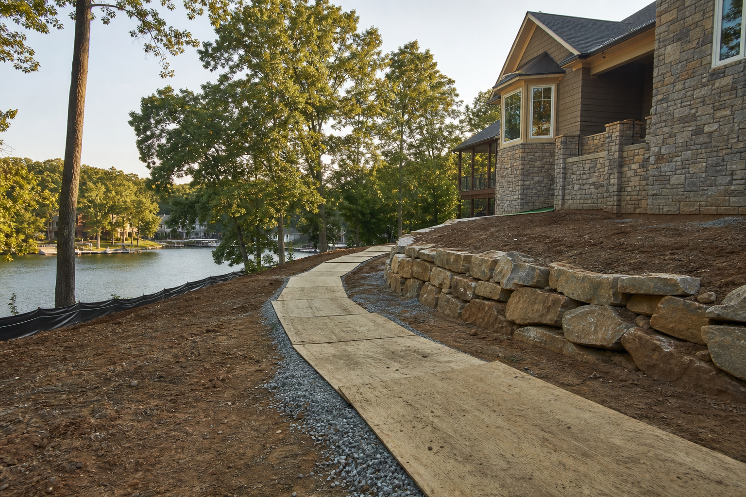
A waterfront owner can map access constraints before exterior construction begins by walking the property with a simple logistics checklist that covers slope, existing improvements, drainage paths, likely material staging areas, protection needs for the shoreline and neighboring properties, and a plan for restoring disturbed ground once work wraps up. Doing this before a contractor mobilizes equipment or materials helps surface conflicts, such as a retaining wall that blocks a delivery route or a downslope drainage swale that could carry sediment toward the lake, while there is still time to adjust the plan.
This article is intended for general planning education and does not replace a site-specific review by a qualified professional or the applicable permitting authority. York County, South Carolina publishes zoning and stormwater plan review information that applies to many Lake Wylie area properties, and those pages are the factual floor for any regulatory statement in this article. Requirements can change, vary by parcel, and depend on factors this article cannot evaluate remotely, so property owners should confirm current requirements directly with York County or the authority having jurisdiction before relying on any planning assumption made here.
What current public sources establish
York County, South Carolina maintains two published resources that are directly relevant to shore-side exterior projects near Lake Wylie: a Zoning page and a Stormwater Plan Review page. The Zoning page addresses land use and dimensional standards that can apply to a given parcel, while the Stormwater Plan Review page addresses when and how a stormwater plan may need to be submitted and reviewed by the county. Both pages are maintained by York County government and represent the most current published starting point for owners trying to understand what the county expects on a given property.
It is important to separate what these public sources establish from what a homeowner or contractor might assume based on experience with other lake properties or other jurisdictions. Zoning designations, setback requirements, overlay districts, and stormwater thresholds can differ from one property to the next depending on lot configuration, prior approvals, and other site-specific factors that are not visible from a general reading of a county web page. Because requirements can change and can vary by parcel, this article treats the York County pages as the factual floor and directs readers to confirm any project-specific detail directly with the county before making planning decisions.
- The York County Zoning page addresses land use and dimensional standards that may affect a property.
- The York County Stormwater Plan Review page addresses when a stormwater plan may need to be submitted.
- Both pages are maintained by York County and can be updated, so the current version should always be checked.
- Neither page substitutes for a property-specific determination from county staff or a licensed professional.
Inputs and existing conditions to document
Before any exterior work begins, a waterfront owner benefits from compiling a written and photographic record of existing site conditions. This is not a substitute for a survey or engineering review, but it gives the owner and the project team a shared reference point when discussing access, staging, and protection. Useful inputs include the general slope of the lot from the house down to the water, the location of any existing retaining walls, steps, patios, driveways, or utility lines, and any visible drainage paths, swales, or low areas where water tends to collect after rain.
Existing improvements deserve particular attention because they often define the practical limits of where equipment can travel and where materials can be staged. A narrow side yard, a steep exterior stair, or a retaining wall near the shoreline can all constrain how a project team plans deliveries and work sequencing. Documenting these conditions early, even in simple photographs with notes on approximate dimensions, helps avoid surprises once a project team begins detailed planning.
- Note the general slope direction and any noticeably steep sections between the house and the water.
- Photograph and describe existing retaining walls, stairs, patios, driveways, and visible utility features.
- Mark any areas where water visibly pools, channels, or erodes soil after rainfall.
- Identify the narrowest points of access on the property, including gates, side yards, and shared driveways.
Step-by-step owner and project-team review
A practical way to organize this work is to walk the property in a deliberate sequence rather than relying on a single general impression. Starting at the most likely delivery or staging point, such as the driveway or street frontage, an owner can trace the probable path materials and equipment would take to reach the work area, noting any pinch points, low branches, slopes, or existing hardscape that could be affected. From there, the walk can continue toward the shoreline, paying attention to how close any proposed work area is to the water and to any existing drainage or retaining features.
This walk is most useful when it is done jointly with the project team once one is engaged, since a contractor or design professional may see access or protection issues that are not obvious to an owner. Sharing the documented existing conditions from the previous step gives that discussion a concrete starting point. The goal of this step-by-step review is not to produce a final plan, but to generate a clear list of questions and observations that can be brought to the appropriate professionals and to the county before work is scheduled.
- Trace the likely path from the street or driveway to the work area and note any tight or steep sections.
- Walk from the house toward the shoreline, noting proximity of proposed work to the water and any drainage features.
- Identify areas that would need protection, such as existing landscaping, trees, or neighboring property lines.
- Compile observations into a list of specific questions for the project team and the county rather than assumptions.
Responsibilities, dependencies, and hold points
Exterior projects on sloped, waterfront lots typically involve more than one party with distinct responsibilities, and it helps to be clear about who is responsible for what before work begins. The property owner is generally responsible for providing accurate information about the site and for obtaining any required approvals from the county or other authority having jurisdiction. A contractor or design professional is generally responsible for translating site conditions into a practical work plan, including material staging, equipment access, and protective measures, but that plan should still be reviewed against the owner's documented observations and any applicable regulatory requirements.
Certain steps naturally depend on others being completed first, and recognizing these dependencies as hold points can prevent wasted effort. For example, finalizing a material staging plan before confirming whether a stormwater plan is required, or before confirming zoning setbacks that might affect where structures or staging areas can sit, can lead to rework. Building in a deliberate pause to confirm regulatory requirements with York County before finalizing site logistics is a reasonable hold point for most shore-side projects.
- Owners are generally responsible for accurate site information and for pursuing required county approvals.
- Contractors and design professionals are generally responsible for translating site conditions into a workable plan.
- Confirming zoning and stormwater requirements is a reasonable hold point before finalizing staging and access plans.
- Any hold point should be revisited if site conditions change, such as after a significant storm or excavation.
Common coordination failures
Several recurring coordination problems can arise on lake lot exterior projects when access planning is treated as an afterthought. One common failure is assuming that a driveway or side yard that comfortably fits a personal vehicle will also accommodate delivery trucks, equipment, or stacked materials, only to discover during mobilization that the route is too narrow or too steep. Another is underestimating how close a proposed staging area sits to a drainage path, which can lead to sediment or runoff issues that affect neighboring properties or the shoreline itself.
Neighbor relationships are another frequent source of friction when access has not been mapped in advance. Shared driveways, property line fences, or overlapping sightlines to the lake can all become points of disagreement if a project team has not communicated with adjacent owners about staging locations, work hours, or temporary protective barriers. Taking the time to identify these potential friction points during the access mapping stage, and raising them proactively with neighbors and the project team, tends to reduce the likelihood of disputes once work is underway.
- Assuming a personal-vehicle driveway will also accommodate delivery trucks and staged materials.
- Underestimating proximity between a staging area and an existing drainage path or the shoreline.
- Failing to communicate staging locations and work hours with adjacent property owners in advance.
- Skipping a written restoration plan for disturbed lawn, landscaping, or shared access areas.
Questions for the responsible authority or qualified professional
Because zoning and stormwater requirements can be specific to a parcel and can change over time, an owner should bring a written list of questions to York County staff and to any licensed professional involved in the project rather than relying on general assumptions from this article. For the county, useful questions include whether the specific property falls under any zoning overlay or setback requirement that could affect staging or construction footprint, and whether the scope of the planned exterior work is likely to require stormwater plan review given the property's location relative to the lake.
For a design professional, surveyor, or engineer, useful questions include whether the documented slope and drainage observations are sufficient for planning purposes or whether a more formal survey or drainage assessment is warranted before finalizing access and staging plans. Asking these questions early, and in writing where practical, creates a clearer record for the owner and reduces the chance that a requirement is discovered only after materials have already been staged or work has begun.
- Does this property fall under any zoning overlay or setback that could affect staging or construction footprint?
- Is a stormwater plan likely to be required given this property's proximity to the lake and the planned scope of work?
- Are the owner's documented slope and drainage observations sufficient, or is a formal survey or assessment needed?
- What documentation should be kept on file in case a county reviewer requests it during or after the project?
Next action and related CDG service resource
Mapping access constraints before exterior work begins is one part of a broader home remodeling planning process for waterfront properties, and it works best alongside a clear understanding of the specific project scope, whether that involves a patio expansion, a stair replacement on a sloped lot, a retaining feature renovation, a screened porch addition, an outdoor kitchen, or a driveway revision. Each of those project types carries its own access and drainage considerations, and reviewing the relevant planning questions for that specific scope alongside the general access mapping described in this article can help an owner enter conversations with contractors and the county better prepared.
Owners who want to discuss general planning considerations for a Lake Wylie area exterior project, including how access, drainage, and site protection questions might apply to their specific property, can review general remodeling information at /remodeling/ or browse related planning articles at /blog/. For those ready to discuss a specific property and project scope, scheduling a conversation through /consultation/ is a reasonable next step, with the understanding that any code, permitting, or engineering determination will still need to be confirmed with the authority having jurisdiction or an appropriately licensed professional.
- Review general remodeling planning information at /remodeling/ before finalizing a project scope.
- Browse related lake lot planning articles at /blog/ for scope-specific access and drainage questions.
- Use /consultation/ to discuss a specific property and project scope with the project team.
- Keep county confirmation of zoning and stormwater requirements as a required step regardless of project scope.
Questions homeowners ask
Who decides whether a stormwater plan is required for a Lake Wylie shore-side project?
York County, South Carolina is the authority that publishes stormwater plan review guidance, and the county's stormwater office is the appropriate contact for determining whether a specific project triggers plan review. Because thresholds and submission requirements can be tied to disturbed area, proximity to water, or other site-specific factors, an owner should not assume a project is exempt without checking directly with the county. The York County Stormwater Plan Review page linked in this article is a starting point, but current, project-specific direction should come from the county itself.
Does zoning affect where equipment and materials can be staged on a lake lot?
Zoning regulations can influence setbacks, lot coverage, and other dimensional standards that may indirectly affect where staging areas, driveways, or temporary access routes can be placed on a property. York County's Zoning page is the primary published resource for these standards in the county, but zoning designations and any variances or overlays that apply to a specific parcel should be confirmed with York County zoning staff before finalizing a staging plan.
Can Cooper Development Group tell me exactly what my property needs before I call the county?
Cooper Development Group can walk through general planning considerations such as slope, drainage, access routes, and site protection as part of a broader remodeling conversation, but property-specific code, permitting, environmental, or engineering determinations must come from the responsible authority having jurisdiction or a licensed professional in that field. A consultation can help an owner organize questions and site observations to bring to those conversations, but it is not a substitute for the county's own review process.
What should I do if I discover a drainage or slope issue during my own walk of the property?
Document what is observed, including approximate locations, slope direction, and any visible erosion, standing water, or existing drainage structures, and keep that information available for discussion with a qualified professional or the county stormwater office. Avoid making assumptions about whether an observed condition meets or fails any specific standard, since that determination belongs to the authority having jurisdiction or an appropriately licensed engineer.
Plan the next step
Use this article as a planning aid, then confirm project-specific requirements with the responsible authority and qualified professionals. Review CDG's related service, construction articles, or consultation page when you are ready to organize the next decision.
Official sources and verification
Authority pages, forms, fees, review steps, and code references can change. Verify the current path for the property and scope before relying on a planning assumption.