
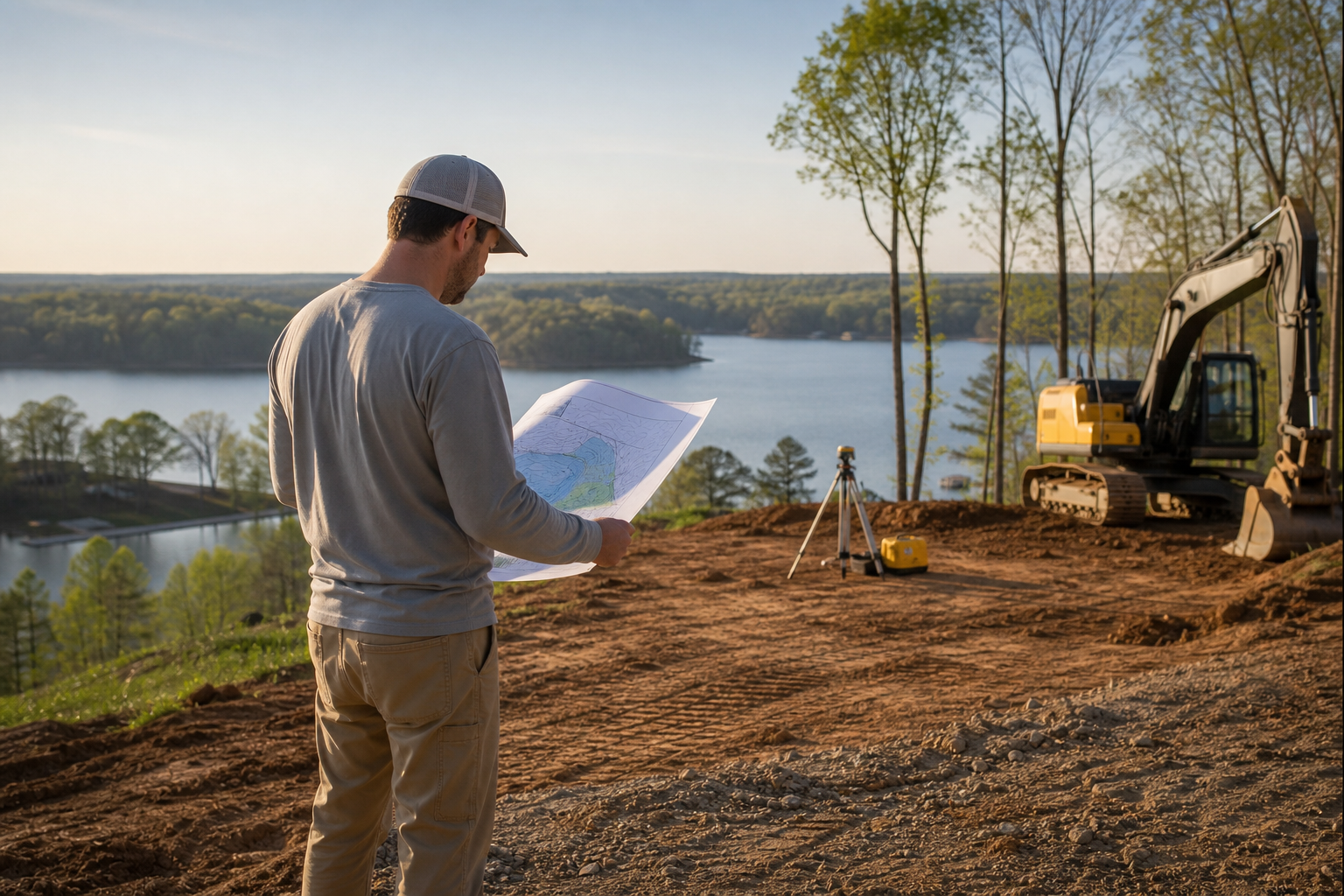
Before a floor plan is sketched for a Lake Wylie lot, a buyer should verify three things directly against public records: the mapped flood zone for the parcel, the base flood elevation tied to that zone, and the local floodplain permitting path that applies in York County or the relevant jurisdiction. This is not a paperwork afterthought. Where the flood map places a lot, and how a surveyor documents existing grade against base flood elevation, shapes where a home can sit, how high the finished floor must be planned, how stormwater and access are routed, and what a site plan can even attempt before schematic design starts.
This article summarizes what York County's floodplain management program and FEMA publish about flood mapping and individual property risk. It does not replace a site-specific determination. Flood zone designations, base flood elevation data, and local permitting requirements can change, and only the authority having jurisdiction, in this case York County, South Carolina, along with FEMA's published maps, can confirm the current requirements for a specific parcel. A licensed surveyor and, where elevation certificates or engineering judgments are needed, a licensed professional should be engaged before any design or construction decision is finalized.
What the Responsible Public Authority Documents
York County's floodplain management program exists to administer the National Flood Insurance Program locally and to maintain the floodplain maps that apply within the county, including areas around Lake Wylie. The county's floodplain management page is the place to start when a buyer wants to know whether a specific parcel falls inside a mapped Special Flood Hazard Area, what flood zone designation applies, and what local permitting steps are triggered by that designation. FEMA maintains the underlying Flood Insurance Rate Maps that counties like York County use, and FEMA's individual-focused floodplain management resources explain, at a national level, how flood zones are defined, how base flood elevation is established, and what steps a property owner can take to understand personal flood risk.
These two sources describe different pieces of the same picture. FEMA sets the mapping framework and publishes general guidance for individuals trying to understand flood risk. York County administers how that framework applies locally, including any permitting or floodplain development review that a specific lot may require before construction can proceed. Neither source can tell a buyer, in general terms, exactly what a given Lake Wylie lot requires. That determination has to come from pulling the actual map panel for the parcel and, where needed, requesting a written determination or letter from the county.
- York County's floodplain management page identifies the local point of contact for floodplain determinations and permitting questions tied to mapped flood zones.
- FEMA's floodplain management resources for individuals explain flood zone types, base flood elevation concepts, and general steps for understanding personal flood risk.
- Neither source substitutes for a parcel-specific determination, and both explicitly direct property owners to verify current requirements before acting.
Decision Inputs to Collect Before Work Proceeds
A buyer or project team should treat flood risk verification as a set of specific documents to collect, not a general impression to form. The first input is the current FEMA flood map panel for the parcel, showing the flood zone designation and, where mapped, the base flood elevation for that zone. The second input is a current survey of the lot showing existing grade, because base flood elevation only becomes a usable planning number once it is compared against actual site elevations at the specific building location. The third input is a written statement from York County's floodplain administration on what local permitting or review applies to the parcel, since local administration can add procedural steps beyond the base FEMA map designation.
These three inputs, map designation, surveyed grade, and local permitting path, need to be gathered before schematic design starts, not fitted in afterward. A floor plan drawn without knowing the base flood elevation risks describing a finished floor height that does not reflect what the site and jurisdiction actually require. A site plan drawn without a current survey risks placing structures, driveways, or utilities in relation to grade assumptions that turn out to be wrong once elevation data is confirmed. Collecting these inputs early is a scheduling decision as much as a technical one, because it determines what design work can safely begin and what remains provisional until confirmed.
- The current FEMA flood map panel and any associated base flood elevation data for the specific parcel, not a general area estimate.
- A current, site-specific survey showing existing grade at the proposed building location and across drainage paths on the lot.
- A written determination or clarification from York County's floodplain administration on what local review or permitting the parcel triggers.
- Any elevation certificate that may already exist for the parcel from prior transactions or prior construction activity.
A Step by Step Owner and Project Team Checklist
Before design work begins, a buyer working with a project team can move through a defined sequence rather than treating flood verification as a single step. Start by identifying the flood zone designation using the current FEMA map for the parcel, then confirm whether York County shows any additional local floodplain overlay or permitting requirement tied to that zone. Next, commission or request a current survey that ties existing site elevations to the datum referenced by the flood map, since base flood elevation numbers are only meaningful when compared against an actual surveyed benchmark on the lot.
Once flood zone, base flood elevation, and surveyed grade are documented, the next step is confirming with York County what permitting path applies, including whether a floodplain development permit or elevation certificate will be required as part of any building permit process. Only after these steps are complete does it make sense to move into site planning decisions about building placement, driveway and utility routing, and grading, since those decisions depend on knowing where the lot sits relative to mapped flood risk. Schematic design of the home itself should follow, not precede, this sequence, because finished floor elevation planning depends on confirmed base flood elevation data rather than an assumption made early to keep a design schedule moving.
- Pull the current FEMA flood map panel for the parcel and record the flood zone designation shown.
- Contact York County's floodplain management program to confirm local permitting requirements tied to that zone designation.
- Commission a current survey referencing the same elevation datum used by the flood map, covering the proposed building area and drainage paths.
- Compare surveyed grade against any published base flood elevation before finalizing site plan concepts.
- Confirm with the county what documentation, such as an elevation certificate, will be required as part of the permitting process.
- Hold schematic design of the floor plan until flood zone, base flood elevation, and permitting path are documented in writing.
Documentation and Hold Points
Every step in the sequence above should produce a document, not just a verbal confirmation, because flood risk decisions affect permitting, financing, and long-term property records. The flood map panel itself should be saved with its effective date, since FEMA periodically updates maps and an outdated panel can misrepresent current risk. Any written response from York County's floodplain administration regarding permitting requirements should be kept on file, along with the survey showing elevation data tied to the same datum referenced on the flood map.
These documents also function as hold points in a project schedule. A hold point is a stage where work should not proceed until specific information is confirmed in writing. For a Lake Wylie lot, reasonable hold points include the point before schematic design begins, where flood zone and base flood elevation should already be documented, and the point before site grading or foundation planning begins, where surveyed grade and any required elevation certificate should be finalized. Skipping past a hold point because a schedule feels tight is exactly how mapped flood risk gets discovered late, when correcting a decision costs more in redesign time than it would have cost to verify upfront.
- Save the FEMA flood map panel with its effective date, since map revisions can change a parcel's designation over time.
- Keep written correspondence from York County's floodplain administration describing the permitting path for the parcel.
- Retain the survey and any elevation certificate referencing the same datum used by the flood map for the property.
- Treat the start of schematic design and the start of site grading as hold points that require confirmed documentation before proceeding.
Common Coordination Failures and How to Catch Them
One recurring failure is relying on a flood zone impression from a real estate listing or a general area reputation rather than pulling the actual current FEMA map panel for the parcel. Lake Wylie shoreline lots can vary in flood zone designation over short distances, and a neighboring property's flood status does not confirm a specific parcel's status. Another common failure is using a survey that was completed for a different purpose, such as a boundary survey without elevation data, and assuming it satisfies flood elevation planning needs. Elevation data tied to the correct datum is a distinct deliverable from a boundary survey, and a project team should confirm which type of survey has actually been performed.
A third failure is treating the county floodplain permitting question as resolved once a general zone designation is known, without confirming in writing what local review steps apply. York County's administration of floodplain requirements can involve documentation beyond the base FEMA designation, and assuming no additional steps apply without asking is a common source of late-stage delay. A fourth failure worth watching for is allowing schematic design to proceed on an assumed finished floor elevation before base flood elevation and surveyed grade are both confirmed, since a design built around a wrong assumption often needs revision once the real numbers arrive. Catching these failures early usually comes down to insisting on written confirmation at each step rather than proceeding on assumption or informal conversation.
- Do not assume a parcel's flood zone based on nearby properties or general area reputation. Pull the specific map panel for the lot.
- Confirm whether an existing survey includes elevation data tied to the flood map's datum, or only boundary information.
- Get written confirmation from York County on permitting steps rather than assuming a general zone designation is the full picture.
- Avoid finalizing schematic design around an assumed finished floor elevation before base flood elevation and surveyed grade are both documented.
Questions for the Responsible Authority or Qualified Professional
When contacting York County's floodplain management program or reviewing FEMA's published resources, it helps to arrive with specific questions rather than a general request for information. Useful questions include what flood zone designation currently applies to the parcel, what base flood elevation is published for that zone if any, and what local floodplain development permitting steps apply before a building permit can be issued. It is also worth asking whether an elevation certificate will be required, and if so, at what stage of the project it needs to be completed and by whom.
For questions that involve professional judgment, such as how to interpret surveyed grade against base flood elevation for a specific design, or how to plan finished floor elevation relative to both floodplain requirements and site drainage, a licensed surveyor or licensed design professional should be engaged directly. CDG's site planning role includes coordinating with these professionals and with the responsible jurisdiction, but the flood zone determination itself and any related permitting decision remain matters for York County and FEMA's published maps, not a matter of general contractor judgment.
- What flood zone designation and base flood elevation, if any, currently apply to this specific parcel.
- What floodplain development permitting steps, if any, apply locally before a building permit can be issued.
- Whether an elevation certificate is required, and at what project stage it needs to be completed.
- Who is authorized to certify elevation data for permitting purposes on this parcel.
Next Action and Related CDG Planning Resource
The practical next step for a buyer considering a Lake Wylie lot is to request the current flood map designation and any published base flood elevation for the parcel before spending time or money on schematic floor plan concepts. Pairing that map information with a current, elevation-referenced survey and a written confirmation from York County on permitting steps gives a project team an accurate starting point rather than a set of assumptions that may need to be unwound later in the process.
CDG's site planning work in the Lake Wylie area is organized around this kind of sequencing, gathering map, survey, elevation, and jurisdiction information before design decisions are locked in. Readers can review CDG's site planning service page for a broader look at how site-level planning decisions are approached, browse the CDG blog for related articles on drainage, elevation, and grading topics connected to this same planning sequence, and reach out through the CDG consultation page to discuss a specific parcel and its documented flood mapping status.
- Review the CDG site planning service page for a broader description of how site-level planning decisions are sequenced.
- Browse the CDG blog for related articles on drainage paths, elevation planning, and grading topics tied to this same preflight sequence.
- Use the CDG consultation page to discuss a specific Lake Wylie parcel once flood map and survey documentation has been gathered.
Questions homeowners ask
Where can a buyer find the current flood zone designation for a specific Lake Wylie lot?
The current flood zone designation comes from the FEMA flood map panel that covers the parcel, and York County's floodplain management program can help confirm which panel and designation applies locally. Because map panels are periodically updated, a buyer should request the current effective panel rather than rely on an older map or a general area impression, and should verify the designation directly with York County before relying on it for design decisions.
Does a boundary survey provide enough information to plan around base flood elevation?
Not necessarily. A boundary survey documents property lines but does not always include elevation data referenced to the datum used by the flood map. Before base flood elevation can be used in planning, a project team should confirm whether the survey on hand includes elevation data tied to the correct datum, and if not, request a survey deliverable that does before finalizing site plan or floor plan decisions.
Who decides what floodplain permitting steps apply to a specific parcel near Lake Wylie?
York County's floodplain management program administers local floodplain permitting requirements, working within the framework of FEMA's flood maps and the National Flood Insurance Program. A parcel-specific determination should come directly from York County rather than from a general understanding of how nearby properties were handled, since permitting requirements can vary by zone designation and can change over time.
Should schematic design begin before flood zone and elevation data are confirmed?
Practical planning guidance is to treat flood zone confirmation, base flood elevation data, and surveyed grade as inputs gathered before schematic design begins rather than during it. Starting design work around an assumed finished floor elevation risks requiring revisions once the actual base flood elevation and surveyed grade are confirmed, so holding schematic design until these inputs are documented in writing is the more predictable sequence.
Plan the next step
Use this article as a planning aid, then confirm project-specific requirements with the responsible authority and qualified professionals. Review CDG's related service, construction articles, or consultation page when you are ready to organize the next decision.
Official sources and verification
- York County, South Carolina: Floodplain Management
- Federal Emergency Management Agency: Floodplain Management Resources for Individuals
Authority pages, forms, fees, review steps, and code references can change. Verify the current path for the property and scope before relying on a planning assumption.