
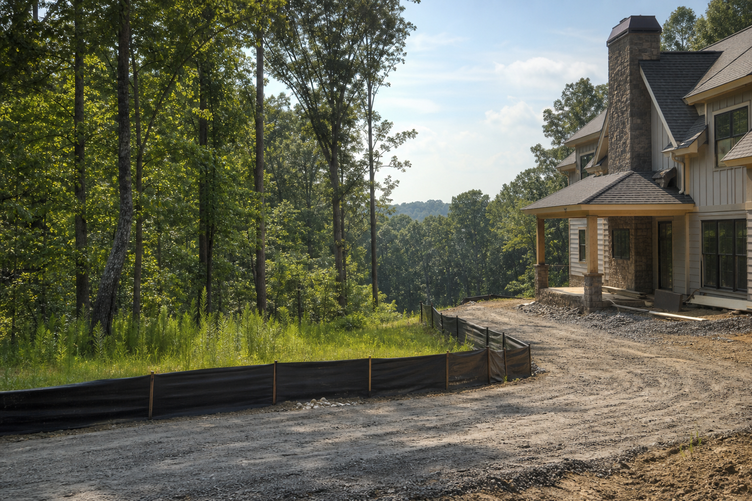
Keeping a septic reserve area protected during custom home design means treating the reserve drainfield as a fixed, non-negotiable boundary on every plan sheet, not just a note on the original soil evaluation. A practical routine is to overlay the reserve area boundary onto the site plan, the grading plan, the landscape plan, and the utility plan every time one of those drawings is revised, so structures, driveways, grading cuts, planting beds, and future service lines are checked against that boundary before construction begins rather than after a problem appears.
This article explains a coordination approach, not a regulatory determination. Septic system requirements, including reserve area sizing, setbacks, and protection measures, are established and enforced by state and local environmental health authorities. In South Carolina that authority is the Department of Environmental Services, and in Mecklenburg County it is the county Environmental Health division. Requirements can change and vary by jurisdiction, soil condition, and system type, so every project-specific reserve area requirement must be verified with the authority having jurisdiction before design decisions are finalized.
Direct Answer and Evidence Boundary
When an owner asks how to keep a wastewater reserve assumption visible while a custom home design moves forward, the short answer is that the reserve area needs to appear as a fixed overlay on every working drawing, updated at every revision, and checked by name at every design meeting. Soil evaluations and the resulting primary and reserve drainfield locations are typically established early in the process, often before final floor plans or landscape concepts exist, and it is common for that early information to get filed away and forgotten as the design develops through multiple iterations.
The practical risk is not that anyone intends to build over a reserve area. It is that a driveway gets shifted six feet for a turning radius, a grading plan adds a swale, or a landscape design adds a row of trees, each decision made by a different team member working from a different drawing, none of whom is looking at the reserve boundary at that moment. A visible, repeated overlay routine closes that gap by making the reserve boundary a standing reference on every discipline's drawing set, not a one-time note buried in a soil report.
What Current Public Sources Establish
Septic system regulation, including requirements related to reserve areas, is handled at the state and local level. In South Carolina, the Department of Environmental Services maintains the regulations, forms, and fact sheets that govern septic tank permitting and system design. In Mecklenburg County, North Carolina, the county Environmental Health division administers groundwater and wastewater services locally, including septic permitting within county jurisdiction. These are the primary sources a design team should consult for any project located in these jurisdictions.
These published sources establish that septic systems require a permitted design reviewed by the relevant environmental health authority, and that soil and site conditions determine drainfield placement and sizing. They do not attempt to prescribe an internal design-coordination workflow for a builder or design team, because that kind of process detail falls outside what a regulatory fact sheet is written to cover. That distinction matters for this article: the regulatory sources establish that a reserve area exists and must be protected, while the specific coordination routine described here is practical planning guidance from Cooper Development Group, not a quoted or paraphrased regulatory requirement.
- South Carolina projects should consult the Department of Environmental Services septic tank regulations, forms, and fact sheets for the current statewide framework.
- Mecklenburg County, North Carolina projects should consult the county Environmental Health groundwater and wastewater services page for local administration details.
- Any other South Carolina or North Carolina jurisdiction may have its own local health department contact and process, which should be identified early in design.
Inputs and Existing Conditions to Document
Before a design team can protect a reserve area on paper, it needs a clear, dated record of what was actually approved or evaluated on that specific lot. This starts with the soil evaluation or percolation information used to establish both the primary and reserve drainfield locations, along with any sketch, plat, or permit document showing their boundaries relative to property lines and other site features.
It also helps to document existing site conditions that could affect the reserve area even if no construction is planned there directly, such as natural drainage patterns, existing tree cover, slope, and any utility easements that cross or run near the reserve boundary. A design team that has this information gathered and dated in one place, rather than scattered across an initial site visit and a separate consultant file, is in a much better position to check new design decisions against it consistently.
- Gather the soil evaluation or percolation test documentation showing primary and reserve drainfield locations.
- Confirm the reserve area boundary is marked with real coordinates or measurable ties to property corners, not just an approximate sketch.
- Note existing slope, drainage paths, and tree cover within and adjacent to the reserve area.
- Identify any recorded easements, setbacks, or utility corridors that intersect or border the reserve area.
Step-by-Step Owner and Project-Team Review
A repeatable overlay routine works best when it is tied to specific points in the design process rather than left to individual judgment about when a check is needed. At each major design milestone, the reserve area boundary should be pulled up and compared against the current version of every relevant drawing, with any conflict flagged before that drawing moves forward to the next stage of design or permitting.
This is not a one-person task. An owner, a designer, a civil or grading consultant, and a landscape designer may each be working on a different piece of the same site plan, and each of them needs the same reserve boundary reference to check their own work against. Building that check into the review sequence, rather than assuming someone else caught it, is what keeps the reserve assumption visible through design changes that happen weeks or months apart.
- Overlay the reserve area boundary on the initial site plan before house placement or driveway alignment is finalized.
- Re-check the boundary against any revised grading plan, especially where cut, fill, or drainage swales are proposed.
- Re-check the boundary against the landscape plan before tree, shrub, or hardscape locations are finalized.
- Re-check the boundary against any driveway, parking, or access path revision, including turning radius or grading adjustments.
- Confirm the reserve area is also shown on any plan addressing future utility service, irrigation, or accessory structures.
Responsibilities, Dependencies, and Hold Points
Reserve area protection depends on several people doing their part in a coordinated sequence, and it helps to be explicit about who is responsible for what rather than assuming it will happen naturally. The soil evaluation and system design are typically the responsibility of a qualified septic designer or the environmental health authority reviewing the permit application, while the builder and design team are responsible for keeping that established boundary visible and unbuilt-upon as the architectural and site design develops around it.
A useful practice is to set hold points in the design schedule where no further work proceeds on grading, driveway, or landscape drawings until the reserve area overlay has been checked and confirmed clear for that revision. This does not need to be a formal inspection; it can be as simple as a dated sign-off note on the drawing set confirming the reserve boundary was checked against that specific revision before it moved forward.
- The septic designer or environmental health reviewer is responsible for establishing and permitting the reserve area location.
- The design team is responsible for keeping the reserve boundary visible on every relevant drawing throughout the design process.
- The owner benefits from asking, at each milestone, whether the reserve area has been checked against the latest plan revision.
- A hold point before finalizing grading, driveway, or landscape plans reduces the chance of an undetected conflict.
Common Coordination Failures
Several recurring patterns show up when reserve areas get compromised during design, and most of them trace back to information not being shared across disciplines rather than any single mistake. A landscape plan developed independently of the site plan is a frequent source of conflict, since tree placement and irrigation lines are sometimes designed without direct reference to the drainfield boundaries. Similarly, a driveway or parking area redesigned late in the process to solve a grading or access problem can shift into reserve area space if nobody re-checks it against the original boundary.
Another common failure is treating the reserve area as protected simply because the primary drainfield is protected, without confirming that grading, fill, or compaction changes elsewhere on the lot do not affect soil conditions in the reserve area itself. Because the reserve area exists specifically to serve as a backup location if the primary system fails, protecting it means protecting its soil and drainage characteristics, not just its footprint on paper.
- Landscape plans developed without direct reference to the reserve boundary can place trees or irrigation lines within the protected area.
- Late-stage driveway or parking redesigns can shift into reserve space if the plan is not re-checked against the original boundary.
- Grading, fill, or compaction elsewhere on the lot can affect reserve area soil conditions even without direct construction on that area.
- Multiple consultants working from outdated versions of the site plan can each miss a conflict that a shared, current overlay would catch.
Questions for the Responsible Authority or Qualified Professional
Because reserve area requirements and protections are established and enforced by state and local environmental health authorities, an owner or design team should raise specific questions with that authority or with a qualified septic professional rather than relying on general practice alone. These questions help confirm what applies to a specific lot, since soil conditions, system type, and local administrative practice can all affect the answer.
It is worth asking directly whether any grading, landscaping, or structural changes proposed near the reserve area require a new review or updated permit, since practices can vary by jurisdiction and by how significantly the site conditions have changed since the original evaluation.
- What documentation confirms the exact reserve area boundary for this specific lot?
- Does any proposed grading, fill, or drainage change near the reserve area require a new review before construction proceeds?
- Are there restrictions on tree removal, planting, or irrigation within or adjacent to the reserve area?
- Does the reserve area remain valid if site conditions change significantly after the original soil evaluation?
- Who should be contacted locally to confirm current reserve area requirements before finalizing design?
Next Action and Related CDG Resource
Protecting a septic reserve area during custom home design works best as an ongoing habit built into the design schedule rather than a single check performed once and forgotten. Reviewing the reserve boundary against the site plan, grading plan, landscape plan, and future service considerations at each design milestone, and confirming any open questions with the responsible environmental health authority, helps keep this assumption visible through the full design process rather than discovered as a conflict during construction.
Owners working through pre-construction planning on a Carolinas lot, including site evaluation questions that touch on septic feasibility, may find it useful to review related planning information before finalizing a design. Cooper Development Group's pre-construction planning resource for the Lake Wylie, South Carolina area covers related site planning topics, and the CDG blog includes further discussion of site planning subjects. Owners with specific questions about how this fits into their own project can reach out through the CDG consultation page to discuss general planning considerations, with the understanding that property-specific septic and code requirements must be confirmed with the authority having jurisdiction.
- Review the pre-construction planning resource for Lake Wylie, South Carolina for related site planning context.
- Browse the CDG blog for additional articles on site planning and pre-construction topics.
- Use the CDG consultation page to discuss general pre-construction planning questions for a specific property.
Questions homeowners ask
Who determines the exact location and size of a septic reserve area?
The reserve area location and size are established through a soil evaluation and system design process reviewed by the relevant state or local environmental health authority, such as the South Carolina Department of Environmental Services or a county environmental health division like Mecklenburg County's. A qualified septic designer typically prepares this information as part of the permitting process, and any project-specific determination should be confirmed directly with that authority.
Can landscaping or a driveway ever be placed within a septic reserve area?
This depends on the specific requirements of the jurisdiction and the nature of the proposed landscaping or driveway improvement, since some activities may affect soil conditions or future accessibility of the reserve area more than others. Because this is a property-specific and jurisdiction-specific question, it should be raised directly with the environmental health authority or a qualified septic professional before any design decision is finalized.
What happens if a reserve area is compromised before or during construction?
The specific consequences and required corrective steps depend on the jurisdiction, the nature of the compromise, and the current regulations in place at the time, so this is not something that can be answered in general terms. Any concern about a potentially compromised reserve area should be raised promptly with the responsible environmental health authority or a qualified septic professional so it can be evaluated against the applicable requirements.
Does a reserve area need to be re-evaluated if site conditions change after the original soil evaluation?
Practices on this vary by jurisdiction, and significant changes to grading, drainage, or site conditions near the reserve area may or may not require a new review, depending on the extent of the change and current local requirements. This question should be directed to the environmental health authority having jurisdiction over the property to confirm what applies to a specific site.
Plan the next step
Use this article as a planning aid, then confirm project-specific requirements with the responsible authority and qualified professionals. Review CDG's related service, construction articles, or consultation page when you are ready to organize the next decision.
Official sources and verification
- South Carolina Department of Environmental Services: Septic Tank Regulations, Forms, and Fact Sheets
- Mecklenburg County Environmental Health: Groundwater and Wastewater Services
Authority pages, forms, fees, review steps, and code references can change. Verify the current path for the property and scope before relying on a planning assumption.