
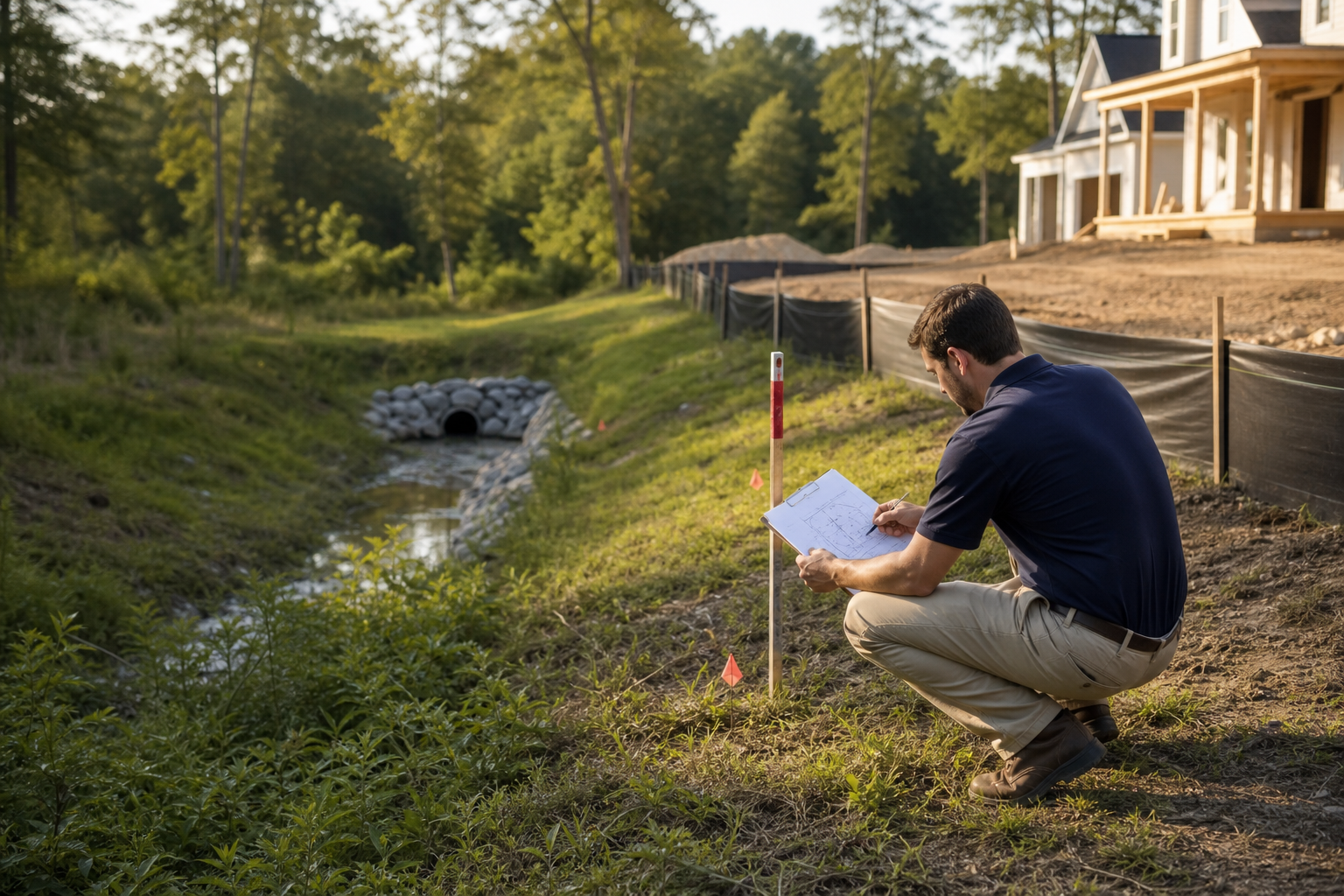
Before proposing any structure, addition, patio, fence, grading change, or fill near a stormwater easement, an owner should verify the recorded easement boundaries, confirm what the easement legally protects (a pipe, channel, pond, or overland flow path), and contact the jurisdiction's stormwater and permitting staff to learn what activity, if any, is allowed inside or near that easement on the specific parcel. This is the core of stormwater easement building due diligence: matching the recorded document, the physical field conditions, and the current agency position before spending money on design.
This article summarizes what publicly available city sources say about stormwater review and residential lot processes, and it adds a general sequence for organizing records and field observations. It is not a substitute for a title search, a licensed surveyor, a civil engineer, or a determination from the authority having jurisdiction. Municipal review criteria, submittal formats, and easement-specific restrictions can change, and every property should be verified directly with the responsible local agency before an owner commits to a design or a contractor scope.
Direct Answer and Evidence Boundary
An owner who is considering a structure, grading change, or hardscape near a stormwater easement should start by treating the easement as a legal and physical constraint that exists independently of the owner's design preferences. Stormwater easement building due diligence means confirming what is recorded, what is physically present in the field, and what the local jurisdiction currently allows, in that order, before any design work is finalized. Skipping straight to design without this sequence often produces plans that must be revised later, sometimes after money has already been spent on drawings or early site work.
It is important to separate what is published by a public agency from general planning guidance offered here. The City of Charlotte maintains public pages describing stormwater projects and an individual residential lot review process, and those pages are cited later in this article as the factual floor for this topic. Everything beyond those specific published statements, including the step-by-step sequence described in this article, reflects general planning practice and should be confirmed against the current requirements of the authority having jurisdiction for the specific property in question.
What Current Public Sources Establish
The City of Charlotte's Stormwater Projects page describes stormwater-related project activity managed by the city and is a useful reference point for understanding how a municipality organizes its stormwater program at a general level. Separately, the city's Individual Residential Lot Reviews page describes a process available for residential lot review, which is relevant context for owners planning work on a single lot rather than a larger subdivision.
These two sources establish that a municipality can maintain both a broader stormwater program and a distinct pathway for individual lot review, and that owners working within that jurisdiction have a defined place to direct lot-specific questions. Neither page, as summarized here, replaces a parcel-specific easement determination, and this article does not restate specific submittal steps, forms, or fees beyond what is generally described in those public sources. Any owner relying on this information should open the current versions of those pages, or contact the department directly, since page content and review processes can be updated after this article is written.
Inputs and Existing Conditions to Document
Before contacting any authority or engaging a design professional, an owner benefits from assembling a small, organized set of records and field observations. This groundwork does not replace agency review, but it makes any conversation with the jurisdiction, a surveyor, or a civil engineer more productive because the owner arrives with specific documents rather than general questions.
A reasonable starting packet includes the recorded plat or subdivision plan showing the easement, the deed or title documents referencing the easement, any prior survey the owner already has access to, and photographs of the physical drainage feature, if visible, such as a swale, pipe outlet, pond edge, or channel bank. Owners should also note any existing structures, fences, or plantings that already sit near the easement boundary, since those existing conditions can affect what a reviewer considers when evaluating a new proposal.
- Locate the recorded plat, subdivision plan, or easement exhibit that shows the easement's plotted location on the lot.
- Review the deed and any separate easement agreement language for wording about permitted uses, prohibited uses, and agency access rights.
- Photograph the physical drainage feature and surrounding grade if it is visible above ground.
- Note the location of any existing structures, fences, decks, or landscaping already near the easement line.
- Collect any prior survey, site plan, or grading plan the owner already has for the property.
Step-by-Step Owner and Project-Team Review
Once records and field observations are assembled, a general review sequence helps an owner move from raw information to an informed conversation with the responsible authority. The goal of this sequence is not to produce a final answer on buildability, since only the authority having jurisdiction can determine that, but to prepare the owner to ask focused questions and to understand what additional professional input may be needed.
The sequence below is offered as general planning guidance rather than a required or code-mandated process, and it should be adapted to the specific property and jurisdiction involved.
- Confirm the recorded easement location against a current or recent survey rather than relying only on a plat sketch, since built conditions can differ from what was originally recorded.
- Identify whether the easement protects a piped system, an open channel, a detention or retention feature, or an overland flow path, since each type can carry different practical constraints.
- Read any easement agreement language for stated restrictions on structures, fences, grading, or vegetation within the easement area.
- Contact the jurisdiction's stormwater department or growth and development office to ask whether the proposed work location and type require a specific review path.
- Ask whether a licensed surveyor or civil engineer input is expected as part of that jurisdiction's review for work near the easement.
- Document the agency's response, including the name of the department and the date of the conversation, for the owner's own project file.
Responsibilities, Dependencies, and Hold Points
Stormwater easement due diligence involves several parties, and it helps to be clear about who is responsible for which piece of information. The owner is generally responsible for gathering existing records and initiating contact with the jurisdiction. A licensed surveyor is typically the appropriate professional to confirm exact easement boundaries in the field when the recorded plat is unclear or when built conditions appear to differ from the recorded plan. A civil engineer may be needed if the proposed work could affect drainage patterns, grading, or the performance of the stormwater feature itself.
Because these responsibilities depend on each other, certain points in the process function as natural hold points, meaning the owner should pause before committing further money or time. A reasonable hold point occurs after the jurisdiction confirms whether the proposed work location is subject to easement restrictions but before final design drawings are produced. Another hold point occurs after a surveyor confirms field boundaries but before any grading or excavation begins near the easement. Treating these as checkpoints, rather than moving straight through to construction, reduces the chance of discovering a conflict only after work has started.
- The owner is responsible for locating and organizing existing recorded documents and initiating contact with the jurisdiction.
- A licensed surveyor is the appropriate professional to confirm field-verified easement boundaries when records are unclear.
- A civil engineer may be needed when proposed work could change grading or drainage behavior near the easement.
- The jurisdiction's stormwater or growth and development office is the appropriate authority to confirm current review requirements for the specific lot.
- A hold point before final design drawings, and another before grading or excavation, gives the owner a chance to confirm findings before spending further money.
Common Coordination Failures
Several recurring patterns can create delay or added cost for owners working near a stormwater easement, and most of them trace back to skipping a step in the sequence described above rather than to any single technical error. Recognizing these patterns in advance allows an owner to build extra care into the early planning stage.
One common failure is relying only on a plat sketch or a real estate disclosure document without confirming the easement's current field location, particularly on older lots where drainage features may have shifted or been modified over time. Another is assuming that a setback distance from a structure automatically satisfies an easement restriction, when the two are separate concepts governed by different documents. A third is contacting a contractor or designer before contacting the jurisdiction, which can result in a design that later needs revision once the agency's position becomes clear. A fourth is failing to preserve physical access to the easement area during construction staging, which can create conflict with the agency's right to enter and maintain its infrastructure.
- Relying on an old plat sketch instead of confirming the current field location of the easement and any drainage feature.
- Confusing a building setback requirement with a separate easement restriction, since the two are not the same thing.
- Engaging a designer or contractor before confirming the jurisdiction's position on the specific easement and proposed work.
- Storing materials, equipment, or spoil piles in a way that blocks the agency's access to the easement during construction.
- Assuming a neighbor's prior approval for similar work means the same result will apply to a different lot or easement.
Questions for the Responsible Authority or Qualified Professional
Because every jurisdiction and every recorded easement can differ, the most useful thing an owner can do before finalizing a design is to prepare specific questions for the responsible authority and, where appropriate, a licensed surveyor or civil engineer. General questions tend to produce general answers, while questions tied to a specific document or field observation tend to produce more actionable responses.
Owners should expect that some answers may require a site visit, a review of submitted plans, or additional documentation before the authority can respond, and that timelines for that response are set by the jurisdiction rather than by this article or by any contractor. Asking early, and in writing where possible, helps preserve a clear record of what was asked and what was answered.
- What does the recorded easement document say about permitted and prohibited uses within the easement area?
- Is the easement currently used for a piped system, an open channel, a pond, or an overland flow path, and does that change what is allowed above it?
- Does the jurisdiction require a survey, a grading plan, or an engineering review for work located near this specific easement?
- What access does the agency retain for maintenance or repair, and how should that access be preserved during and after construction?
- Are there any pending stormwater projects in the area that could affect this lot, based on the jurisdiction's current published project information?
Next Action and Related CDG Service Resource
The most useful next step for an owner is usually the simplest one: gather the existing plat, deed, and any prior survey for the property, take current photographs of the drainage feature if it is visible, and then contact the jurisdiction's stormwater or growth and development office with those documents in hand. This puts the owner in a position to ask specific questions rather than general ones, and it creates a record that can be referenced later if the project moves forward.
Cooper Development Group's site planning work in the Lake Wylie area, described on the site planning page, addresses early planning coordination for residential projects, and general background on zoning and concept planning topics is also available on the CDG blog. Because every stormwater easement situation depends on the specific recorded documents and the jurisdiction involved, owners considering a project near an easement are encouraged to review that background material, confirm current requirements with the authority having jurisdiction, and reach out through the consultation page when they are ready to discuss how a specific property might be approached.
- Review the site planning service page for Lake Wylie, SC, at /site-planning-lake-wylie-sc/ for related planning context.
- Browse general zoning and planning background articles at /blog/.
- Use /consultation/ to start a conversation about a specific property once initial records have been gathered.
Questions homeowners ask
Can an owner assume a stormwater easement allows no construction at all?
Not necessarily, but an owner should not assume the opposite either. Some easements allow limited surface improvements like landscaping or a permeable path, while others are kept clear for pipes, channels, or agency access equipment. The recorded easement language and the jurisdiction's current stormwater review are the only reliable ways to know what is permitted on a specific lot, so this question should go to the responsible local authority rather than being guessed from a plat alone.
Where does an owner in the Charlotte area start looking for stormwater project or easement information?
The City of Charlotte publishes stormwater project information and a residential lot review process, and those pages are a reasonable starting point for understanding how the city organizes stormwater-related review. However, site-specific easement locations, restrictions, and current submittal steps should still be confirmed with the city's stormwater and growth and development staff, since published overview pages do not replace a parcel-specific determination.
Does hiring a contractor first satisfy stormwater easement due diligence?
No. A contractor can help translate a design intent into a buildable scope, but confirming easement boundaries, agency access rights, and any construction restrictions is a separate step that typically involves title records, a survey, and direct coordination with the jurisdiction's stormwater or growth and development office. Due diligence is most useful when it happens before a design is finalized, not after a contractor has already priced the work.
Plan the next step
Use this article as a planning aid, then confirm project-specific requirements with the responsible authority and qualified professionals. Review CDG's related service, construction articles, or consultation page when you are ready to organize the next decision.
Official sources and verification
Authority pages, forms, fees, review steps, and code references can change. Verify the current path for the property and scope before relying on a planning assumption.