
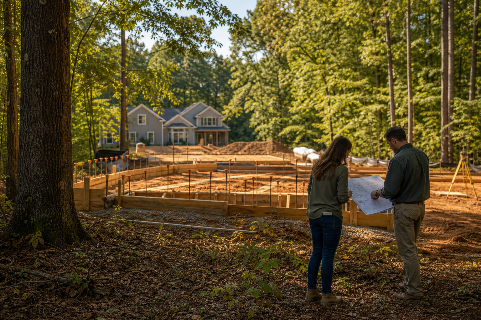
Existing trees become measurable site constraints when a project team documents canopy spread, root zone extent, trunk condition, and species before the house footprint is drawn, then overlays that information on the same base map used for grading, utility, and access planning. Treating trees this way turns tree preservation house placement into a coordination exercise with defined boundaries rather than a landscaping decision made after construction lines are already set.
This article explains how Cooper Development Group approaches early-stage site coordination for residential lots with existing tree cover. It is general planning guidance, not a substitute for a site-specific arborist assessment, a licensed surveyor, a civil engineer, or the review process required by the city or county having jurisdiction over the property. Every requirement referenced here should be verified directly with the applicable authority before a concept plan is finalized.
What Current Public Sources Establish
Local jurisdictions publish their own procedures for how a residential lot is reviewed before construction begins, and those procedures vary by city and county. The City of Charlotte's Individual Residential Lot Reviews page describes the general review path a residential project may go through, including how site conditions on an individual lot are evaluated as part of the broader development process. York County, South Carolina publishes its Land Use Codes, which set out the land use and development standards that apply within the county, including provisions that can affect what happens on a lot with existing vegetation.
Neither of these sources should be read as a complete or final answer for a specific property. Ordinances change, review procedures are updated, and additional overlay districts, watershed rules, or subdivision-specific covenants can apply on top of the base county or city code. Before a concept plan is treated as final, the property owner or their design professional should confirm current requirements directly with the City of Charlotte or York County, or with the equivalent authority having jurisdiction if the lot sits elsewhere. This article treats those two published sources as a factual floor, not as a substitute for that direct confirmation.
Inputs and Existing Conditions to Document
Before a house footprint can reasonably account for trees, someone needs to record what is actually on the lot in a form that can be placed on the same map as the proposed structure. This means locating each tree of meaningful size, noting trunk diameter, species where it can be reasonably identified, general health and structural condition, and the approximate extent of the canopy and root system. Without this baseline, later footprint decisions are guesses rather than informed placements.
Existing conditions documentation should also capture the site's topography, drainage patterns, existing utility easements, and any recorded setbacks or buffer requirements that may already limit where a structure can sit. A tree that appears to be in a convenient location on a flat plan view may sit directly in a drainage swale, an easement, or a required setback once these other layers are added. Gathering this information early, before a footprint is sketched, allows the design team to treat trees as one constraint among several rather than as an isolated landscape feature to be dealt with later.
Owners are often the best source for some of this information, particularly history of the lot, prior grading or fill activity, and any known root damage from past construction or utility work. Combining owner knowledge with a physical survey of the trees themselves produces a more complete and reliable existing conditions record than either source alone.
Step-by-Step Owner and Project-Team Review
A practical review sequence starts with the existing conditions documentation described above, followed by an overlay of the preliminary house footprint, driveway, utility runs, and grading limits on the same base map. This overlay makes it possible to see, in one view, where canopy and root zones intersect with construction activity rather than discovering conflicts after excavation has started.
Once conflicts are visible, the project team can work through them in a defined order: first identifying which trees are proposed for removal, which are proposed for retention, and which fall into a gray area that depends on how close construction activity will come to the root zone. This step often benefits from involvement by a qualified arborist or similar professional who can assess whether a given tree is likely to survive nearby grading, trenching, or soil compaction, since root damage is not always visible from the surface and can take years to show symptoms.
After retention and removal decisions are drafted, the team should revisit the grading and utility plan to confirm that protection measures, such as fencing at the edge of a root protection zone, are physically compatible with equipment access, material staging, and trenching routes. It is common for an early grading plan to work on paper but conflict with a protection zone once actual equipment movement is considered, so this step should not be skipped even when the paper plan looks acceptable.
Responsibilities, Dependencies, and Hold Points
Tree-related decisions do not sit with a single party. The property owner typically holds responsibility for confirming property boundaries, any recorded easements, and whether the jurisdiction requires a tree survey or protection plan as part of the review process. The design or planning team is generally responsible for producing the overlay of proposed construction against documented tree locations, and for flagging conflicts before the footprint is locked in for permitting.
A qualified arborist or similar environmental professional, where one is engaged, is responsible for assessing tree health and root zone extent and for recommending whether a tree can reasonably be protected given the proposed construction activity. Civil engineers or surveyors are typically responsible for confirming that grading and drainage plans are consistent with both the site's topography and any protection measures identified for retained trees. Because these responsibilities overlap, a hold point should exist before the footprint is finalized, meaning construction planning should pause until tree-related conflicts have been reviewed by the appropriate party and resolved on paper.
Utility providers and the jurisdiction's own permitting or planning department represent an additional dependency. Utility easements and required clearances can limit where trenching or overhead lines can run relative to a tree's canopy or root zone, and the jurisdiction may have its own tree preservation or removal permitting requirements that need to be satisfied before site work begins. These dependencies mean that a tree preservation house placement checklist is only useful if it is checked against the utility provider's requirements and the jurisdiction's current review process, not treated as a standalone document.
Common Coordination Failures
One frequent failure is treating tree preservation as a landscaping topic to be addressed after the footprint, grading plan, and utility routing are already finalized. By that point, moving the footprint to avoid a root zone conflict can require redesigning drainage, utility runs, and access all at once, which is a far more disruptive process than accounting for the tree earlier.
A second common failure is assuming that a tree's visible canopy accurately represents its root zone. Root systems frequently extend well beyond the canopy edge, and compaction or excavation outside the visible drip line can still damage roots in ways that affect the tree's long-term stability or health. Relying on canopy alone as a proxy for the protection zone can lead to a plan that looks compliant on paper but still causes root damage during actual construction.
A third failure is underestimating the physical footprint of construction equipment and material staging relative to a protection zone drawn only around the proposed structure. Even when the house itself sits outside a root protection area, delivery trucks, staging piles, or turning radii for equipment can regularly intrude into that zone unless access routes are planned with the same care as the building footprint.
Questions for the Responsible Authority or Qualified Professional
Before finalizing a footprint on a lot with existing trees, it is reasonable for an owner or design team to ask the local jurisdiction whether a tree survey, tree preservation plan, or removal permit is required as part of the review process, and whether any overlay district or watershed protection rule adds requirements beyond the base zoning code. These questions should be directed to the city or county planning or development services department with jurisdiction over the property, since requirements differ between jurisdictions and can change over time.
It is also reasonable to ask a qualified arborist or similar professional whether a specific tree's root zone and structural condition can tolerate the proposed grading, trenching, or compaction nearby, and what protective measures they would recommend if the tree is intended for retention. A civil engineer or surveyor can be asked whether the proposed grading and drainage plan is compatible with those protective measures, and whether utility routing can be adjusted to avoid the root protection zone without compromising required clearances.
Because none of these professionals answer the same question in the same way, and because jurisdictions differ in what they require, owners should treat these as separate conversations rather than assuming one professional's answer covers the full scope of tree-related risk on the lot.
Next Action and Related CDG Service Resource
Owners working through early site decisions on a lot with existing tree cover can use this coordination approach as a starting point for organizing existing conditions information before a concept plan is treated as final. Documenting canopy, root zones, grading, access, and utility conflicts early, and routing tree-specific risk questions to a qualified arborist or the jurisdiction's planning department, keeps tree decisions from becoming a late-stage surprise during construction.
For readers evaluating site planning services in the Lake Wylie area, CDG's site planning resource page describes how early site coordination fits into the broader project process. Readers can also review other planning-focused articles on the CDG blog, and can reach out through the consultation page to discuss a property's specific site conditions with the CDG team, keeping in mind that any property-specific code or environmental determination still needs to go through the authority having jurisdiction or a qualified professional.
Questions homeowners ask
Is a tree survey always required before a house footprint can be finalized?
Requirements vary by jurisdiction, and some cities or counties require a tree survey or preservation plan as part of their residential lot review process while others do not, or only require one under certain overlay districts or lot conditions. The City of Charlotte's Individual Residential Lot Reviews page and York County's Land Use Codes describe general review procedures, but the specific requirement for a given property should be confirmed directly with the applicable planning or development services department before assuming a survey is or is not needed.
How large is a typical tree's root protection zone compared to its canopy?
Root systems often extend beyond the visible canopy edge, sometimes significantly, which means using the canopy drip line alone as a proxy for the root protection zone can understate the area that needs to be protected from grading, trenching, or compaction. A qualified arborist can assess a specific tree's likely root extent based on species, trunk diameter, soil conditions, and site history, and that assessment should inform where protection fencing and access limits are placed rather than relying on a general rule.
Who decides whether a tree should be removed or retained on a residential lot?
That decision typically involves several parties working together rather than one party deciding alone. The property owner generally makes the final call on removal or retention within what the jurisdiction allows, informed by a qualified arborist's assessment of the tree's health and its likely response to nearby construction, and constrained by any tree preservation or removal permitting requirements set by the city or county having jurisdiction over the property.
Plan the next step
Use this article as a planning aid, then confirm project-specific requirements with the responsible authority and qualified professionals. Review CDG's related service, construction articles, or consultation page when you are ready to organize the next decision.
Official sources and verification
- City of Charlotte: Individual Residential Lot Reviews
- York County, South Carolina: York County Land Use Codes
Authority pages, forms, fees, review steps, and code references can change. Verify the current path for the property and scope before relying on a planning assumption.