
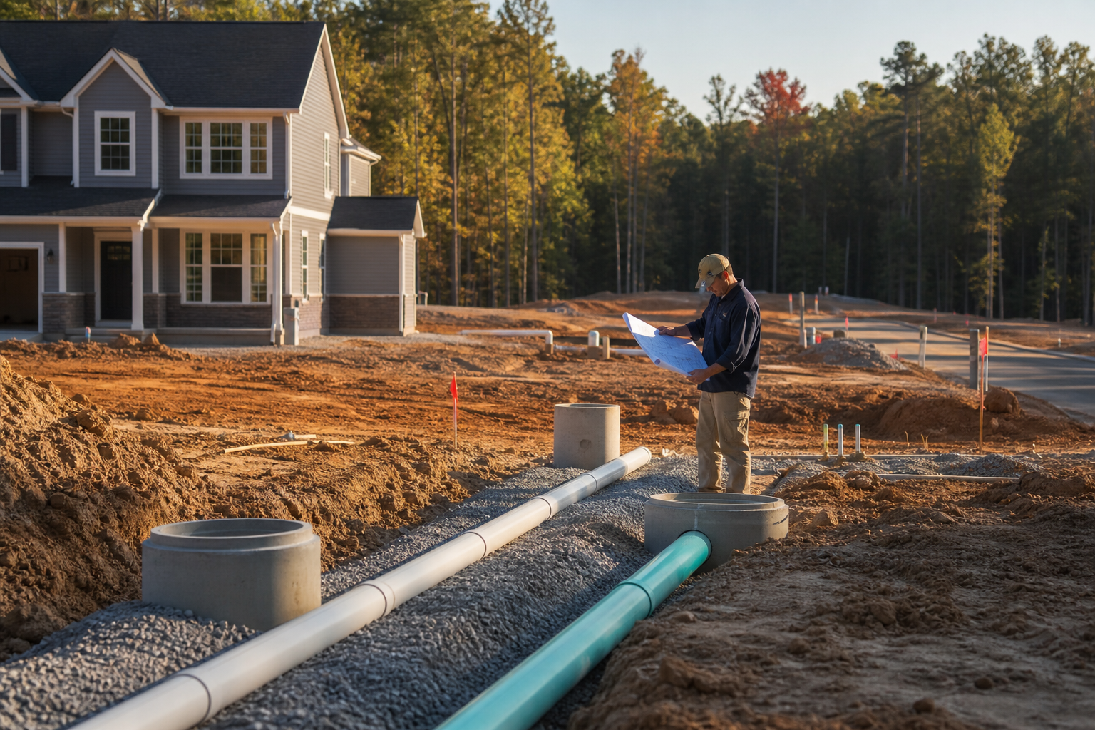
An owner planning a site with public water or sewer service should understand that the utility does not just need a pipe in the ground. It needs a permanent, legally recorded easement wide enough for equipment access, inspection, maintenance, and eventual repair or replacement, and that easement will restrict what can be built, planted, graded, or stored on that strip of land for as long as the utility line exists. Treating the easement as a narrow line on a drawing instead of an access corridor is one of the most common planning mistakes owners make before a utility plan is locked in.
This article summarizes practical planning considerations drawn from publicly available Charlotte Water resources on new connection installations and the current development design manual, alongside general pre-construction planning practices used by Cooper Development Group. It is not a substitute for a jurisdiction-specific review. Easement widths, access requirements, setback rules, and design standards vary by utility provider and by property, and they can change. Every owner should verify current requirements directly with the authority having jurisdiction, which for water and sewer connections inside Charlotte Water's service area means Charlotte Water itself, and for other jurisdictions means the applicable local utility or public works department.
What Current Public Sources Establish
Charlotte Water publishes resources for owners and design teams working through new connection installations, along with a development design manual that lays out engineering and design standards for water and sewer infrastructure. These published materials describe the framework a utility uses to review a proposed connection, including expectations around easement dedication, pipe placement, and access for future maintenance. They are a useful starting point for any owner beginning water sewer easement planning, but they are written for the utility's review process, not as a complete construction guide for a specific parcel.
Because these standards are tied to a specific jurisdiction, an owner outside Charlotte Water's service territory should not assume the same widths, setbacks, or access rules apply. Even within Charlotte's service area, the design manual is periodically updated, and the version in effect at the time of application review is the one that governs. Any owner relying on this article, or on a prior project's easement dimensions, should confirm the current manual and current connection procedures with Charlotte Water or the applicable authority before finalizing a site plan.
- Charlotte Water's New Connection Installations page outlines the general process for establishing a new water or sewer connection.
- The Development Design Standards Latest Design Manual sets out engineering expectations that can affect easement width, pipe depth, and access corridors.
- Both resources are subject to revision, so the version referenced during design should be confirmed as current before submission.
Why the Easement Is an Access Need, Not Just a Pipe Path
It is tempting to think of a water or sewer easement as simply the footprint of the pipe plus a small buffer. In practice, a utility easement exists so that crews and equipment can reach the line long after construction is finished, whether for routine inspection, a planned upgrade, or an unplanned repair. That means the easement has to accommodate the turning radius of service vehicles, the working space needed to excavate safely, and in many cases a graded, reasonably level surface so equipment does not have to fight a slope or a retaining structure to get to the pipe.
When an owner or design team draws the easement as a thin line matching the pipe diameter, they often discover late in the process that the utility requires a much wider corridor, or that structures, fences, trees, or hardscape planned within that corridor will need to be relocated or redesigned. Thinking of the easement as an access need from the earliest site layout, rather than as an afterthought once the pipe route is set, tends to prevent costly redesign later.
- The easement must support vehicle and equipment access, not only the buried pipe itself.
- Grading within the easement often needs to remain workable for excavation equipment.
- Permanent structures, fencing, and some landscaping are commonly restricted within the easement footprint.
Inputs and Existing Conditions to Document
Before an owner or design team can responsibly locate a proposed easement on a site plan, several existing conditions need to be documented rather than assumed. This includes the location of any existing recorded easements on the property, which may already constrain where a new line can go, as well as topography, since grade changes affect both pipe depth and access feasibility. Existing utilities, both public and private, also need to be located and recorded, since crossing conflicts are a frequent source of delay when they are discovered mid-design instead of during planning.
Owners should also gather any prior survey work, recorded plats, and title documents that reference easements, since these records establish the legal boundary of what already exists on the property. A site-plan overlay that layers the proposed facility location, the access corridor, existing grading, other planned improvements, and the verified record documents against each other gives the owner and design team a much clearer picture of where conflicts are likely before construction drawings are finalized.
- Existing recorded easements, plats, and title documents affecting the property.
- Current topography and drainage patterns near the proposed utility route.
- Known locations of other public and private utilities on or near the site.
- Any prior survey work that can be reused or updated rather than repeated.
Step-by-Step Owner and Project-Team Review
A practical review sequence starts with pulling every existing record that touches the property, including recorded easements, prior surveys, and utility as-built drawings if they are available. From there, the design team can sketch a preliminary utility route and overlay it against the documented existing conditions to identify where the proposed facility location conflicts with recorded easements, steep grading, other planned improvements, or existing utility crossings. This overlay step is where many conflicts surface early enough to resolve without redesigning finished construction documents.
Once a preliminary route is validated against the overlay, the next step is confirming access requirements and current design standards with the utility provider, since these details drive the final easement width and any grading or paving expectations within the corridor. Only after that confirmation should the team finalize the site plan for permitting submission. Skipping the confirmation step and submitting based on assumed standards is a common source of resubmittal delays.
- Gather recorded easements, plats, prior surveys, and any available utility as-built records.
- Sketch a preliminary utility route and overlay it against documented existing conditions.
- Identify conflicts between the proposed facility location and grading, other improvements, or existing utilities.
- Confirm current access and design requirements directly with the utility provider before finalizing plans.
- Submit for permitting only after the overlay and confirmation steps are complete.
Responsibilities, Dependencies, and Hold Points
Water and sewer easement planning involves several parties, and it helps for an owner to understand who is generally responsible for what, even though the specific division of tasks can vary by project and by jurisdiction. The utility provider is typically responsible for reviewing and approving the proposed connection and easement dedication against its current design standards. The owner is typically responsible for providing accurate existing-conditions documentation and for recording the easement once it is agreed upon. The design team, which may include a surveyor, civil engineer, or other licensed professional, is typically responsible for translating utility requirements into an accurate, buildable site plan.
Because these responsibilities are interdependent, certain steps naturally become hold points where work should not proceed until an earlier step is confirmed. Grading design, for example, should generally not be finalized until the easement location and required access grading are confirmed with the utility. Similarly, other site improvements planned near the proposed easement, such as parking, landscaping, or accessory structures, should not be locked into final drawings until the easement footprint is verified as recorded or approved.
- The utility provider reviews and approves the proposed connection and easement terms.
- The owner is generally responsible for accurate existing-conditions documentation and easement recording.
- The design team translates utility requirements into a buildable, coordinated site plan.
- Grading and other nearby improvements should wait for easement confirmation before being finalized.
Common Coordination Failures
Several recurring patterns show up when water and sewer easement planning is treated as a late-stage formality rather than an early design input. One is designing site grading and landscaping around an assumed easement width, only to learn during utility review that the actual required corridor is wider or requires a different access grade. Another is failing to reconcile a newly proposed easement against previously recorded easements on the same property, which can create overlapping restrictions or force a redesign of the utility route entirely.
A third common failure is locating other site improvements, such as retaining walls, fences, accessory structures, or mature tree plantings, within or immediately adjacent to a proposed easement without first confirming what is permitted there. Utilities generally restrict permanent structures within an easement corridor because they interfere with future access, and discovering this after construction documents are complete, or after installation, tends to be far more disruptive than catching it during the overlay review described earlier.
- Assuming an easement width instead of confirming it with the utility provider.
- Failing to reconcile a proposed easement against previously recorded easements on the property.
- Locating structures, walls, fences, or plantings within a restricted access corridor.
- Finalizing grading plans before the required access grade within the easement is confirmed.
Questions for the Responsible Authority or Qualified Professional
Because easement requirements are property-specific and jurisdiction-specific, an owner should bring a short list of direct questions to the utility provider or to a licensed civil engineer or surveyor before finalizing a site plan. These questions are meant to surface the practical details that a general article cannot answer for a specific parcel, and they help make sure the design team is working from confirmed information rather than assumptions carried over from a different project or an older version of a design manual.
Owners working within Charlotte Water's service area should direct property-specific questions to Charlotte Water and confirm they are referencing the current version of the design manual, since manual revisions can change easement width, grading, or access expectations between projects.
- What easement width and access grading does the utility require for this specific pipe size and depth?
- Are there existing recorded easements on this property that could affect the proposed route?
- What structures, fencing, or landscaping restrictions apply within the easement corridor?
- Which version of the design manual currently governs this review, and has it changed recently?
- What documentation does the utility require before an easement can be recorded?
Next Steps for Owners Planning a Site
Water sewer easement planning works best when it starts early, alongside broader utility connection planning, rather than as a separate step tacked on after the site plan is mostly finished. Building an overlay of the proposed facility location, the access corridor, existing grading, other planned improvements, and verified property records gives an owner and design team a realistic picture of where conflicts are likely, well before construction documents are locked in. Confirming current requirements directly with the utility provider, and involving a licensed surveyor or civil engineer for property-specific design questions, remains the responsible path for any water or sewer connection project.
Cooper Development Group works with owners on pre-construction planning across remodeling, custom home, and commercial projects, and can help coordinate the site-plan review process described here alongside a design team and the applicable utility provider. Owners working on related infrastructure and site planning questions can review our infrastructure and building systems resource for Lake Wylie, browse related articles on our blog, or reach out through our consultation page to discuss a specific site.
- Start easement planning early, alongside general utility connection planning, not after the site plan is finished.
- Build a site-plan overlay of facility location, access corridor, grading, other improvements, and recorded property documents.
- Confirm current easement and design requirements directly with the utility provider before finalizing plans.
- Involve a licensed surveyor or civil engineer for property-specific design and access questions.
Questions homeowners ask
How wide does a water or sewer easement usually need to be?
Easement width depends on the utility provider's current design standards, the pipe size and depth, and the access equipment needed for maintenance. There is no single width that applies everywhere, so owners should confirm the specific requirement with the utility provider, such as Charlotte Water within its service area, using the current design manual rather than assuming a prior project's dimensions still apply.
Can an owner build or plant within a utility easement?
Utilities generally restrict permanent structures, and often certain landscaping, within an easement corridor because they can interfere with future access for inspection or repair. What is specifically permitted varies by utility and by the terms of the recorded easement, so owners should confirm restrictions directly with the utility provider or a licensed design professional before planning improvements near or within an easement.
What happens if an existing recorded easement conflicts with a proposed new connection?
When a proposed utility route conflicts with a previously recorded easement, the design team typically needs to review both the existing legal record and the utility's current requirements to find a workable path, which may involve adjusting the proposed route or seeking an amendment to the existing easement. This is a property-specific legal and design question, so it should be directed to a licensed surveyor, civil engineer, or the utility provider rather than resolved by assumption.
Who is responsible for recording a new utility easement?
Responsibility for recording an easement is generally shared between the owner and the utility provider, with the owner typically responsible for executing and recording the easement document once its terms are agreed upon through the utility's review process. Exact procedures vary by jurisdiction, so owners should confirm the required steps and documentation with the applicable authority having jurisdiction.
Plan the next step
Use this article as a planning aid, then confirm project-specific requirements with the responsible authority and qualified professionals. Review CDG's related service, construction articles, or consultation page when you are ready to organize the next decision.
Official sources and verification
Authority pages, forms, fees, review steps, and code references can change. Verify the current path for the property and scope before relying on a planning assumption.