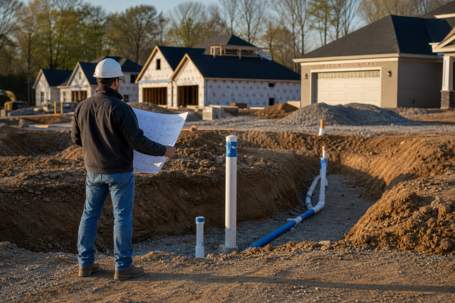
A useful water service route conflict checklist starts by comparing the proposed line path against every fixed and semi-fixed site feature: existing and planned structures, trees and root zones, retaining walls and fences, driveways and paved areas, drainage paths and stormwater structures, other underground utilities, meter and backflow device locations, and the access corridors that maintenance crews will need for the life of the system.
Charlotte Water publishes standards for new connection installations and a design manual that governs how water services are engineered and installed inside its service area, and those documents are the factual floor for anything project-specific. This article explains how to organize a conflict scan around those categories in a practical planning sense, but it does not restate or substitute for the current Charlotte Water requirements. Every property-specific routing, easement, clearance, or approval question must be verified with Charlotte Water or the authority having jurisdiction before design work is finalized.
What Current Public Sources Establish
Charlotte Water maintains published standards for new connection installations and a design manual that sets engineering expectations for water service infrastructure inside its jurisdiction. These are the documents a project team should be treating as the primary reference point whenever a water service route is being planned, not a general contractor's internal notes or a prior project's routing decisions.
Because these standards are updated by Charlotte Water on its own schedule, a route that was acceptable on an earlier project may not reflect current requirements. Anyone using this article as a planning aid should confirm the current version of the design manual and connection installation guidance directly from Charlotte Water before finalizing a route, and should not assume that any summary here reflects the most recent revision.
- Charlotte Water's New Connection Installations page addresses how new water service connections are requested and processed.
- The Latest Design Manual page hosts the current design standards document set that governs technical requirements for water infrastructure.
- Both sources are maintained by Charlotte Water and are subject to change without advance notice to the general public.
- Project teams should treat the published versions at the time of design, not a cached or remembered version, as the operative reference.
Inputs and Existing Conditions to Document
Before a conflict scan can be meaningful, the project team needs an accurate record of what already exists on and near the site. This includes a current survey showing structures, hardscape, and topography, along with any available utility locate information for water, sewer, gas, electric, and communications lines. Without this baseline, a proposed route is being drawn against assumptions rather than facts.
Tree locations and canopy extents matter because root zones can be disturbed by trenching long before the trunk itself appears to be in the way. Existing walls, fences, and paved surfaces matter because removing or working around them can add scope that was not part of the original site plan. Drainage patterns, whether formal stormwater structures or simple grade-driven flow paths, need to be understood so that a new trench does not interrupt water movement the site currently depends on.
- A recent boundary and topographic survey showing structures, hardscape, and grade.
- Utility locate records or as-built drawings for water, sewer, gas, electric, and communications lines.
- A tree inventory noting trunk location, approximate canopy spread, and any protected or significant specimens.
- Documentation of existing drainage paths, swales, and stormwater structures on and adjacent to the site.
- Locations of existing or proposed meters, backflow devices, and any required vaults or enclosures.
Step-by-Step Owner and Project-Team Review
A structured review works best when it moves from the fixed points outward. Start at the proposed meter location and backflow device, since these are often set by the utility and are not freely movable, then trace the proposed route back toward the building connection point and forward toward the main. At each segment, check the route against the documented existing conditions rather than against a mental picture of the site.
It helps to walk the route on paper and on the ground in the same session, since drawings can compress distances and hide small conflicts that become obvious in person. Where the route crosses or runs parallel to another utility, note the horizontal and vertical separation shown on the drawings and flag anything that looks tight for review by the design professional or the utility. Where the route passes near a tree, note the distance from the trunk and whether the trench depth and width would fall within the likely root zone.
- Confirm the meter and backflow device location against the utility's current standards and the site plan.
- Trace the full route segment by segment, checking against structures, walls, fences, and paving.
- Flag any point where the route runs close to or crosses another utility line.
- Note distances from trees and assess whether trenching would disturb root zones.
- Check the route against drainage paths and stormwater structures to avoid blocking or redirecting flow.
- Confirm that the route leaves a workable access corridor for future maintenance or repair.
Responsibilities, Dependencies, and Hold Points
No single party on a project typically owns every piece of information needed for a complete conflict scan. The owner or design professional usually holds the survey and site plan, a civil or utility engineer typically develops the routing and coordinates with the utility, and the contractor is often the one physically encountering conditions in the field once work begins. A conflict scan works best when these parties compare notes before construction rather than after a trench is opened.
Certain points in the process function as natural hold points, meaning work should not proceed past them until the relevant information has been confirmed. Utility locates should be completed and reviewed before excavation. Any route revision prompted by a conflict should be reflected back into the design documents before the change is built. Because Charlotte Water sets its own review and approval process for new connections, the specific sequence and required approvals for any given project should be confirmed directly with Charlotte Water or the responsible design professional.
- The owner and design professional typically hold the survey, existing conditions data, and overall site plan.
- A civil or utility engineer usually develops the proposed route and coordinates it with the utility.
- The contractor typically encounters actual field conditions and should have a channel to report discrepancies quickly.
- Utility locates should be current and reviewed before any excavation begins.
- Route changes should be reflected in updated design documents rather than handled only as a field decision.
Common Coordination Failures
Several patterns show up repeatedly when a water service route is planned without a structured conflict scan. A route may be drawn on an outdated survey that does not reflect a recently added structure, fence, or paved area, leading to a conflict that is only discovered once equipment is on site. A tree that looked far enough away on a plan view may turn out to have a root zone that extends well past the trench line once excavation begins.
Other failures involve utilities that were not fully documented before design, so a proposed water line crosses an unmarked or poorly documented gas, electric, or communications line. Drainage is another frequent miss, where a route change made late in design blocks or redirects a flow path that the site depended on, creating a new problem that was not part of the original scope. Maintenance access is sometimes overlooked entirely, with a route placed in a location that would require disturbing a driveway, wall, or planting bed every time future service work is needed.
- Designing against an outdated survey that does not reflect current structures, walls, or paving.
- Underestimating tree root zone extents relative to trench depth and width.
- Incomplete utility documentation leading to unmarked crossings discovered during excavation.
- Late route changes that unintentionally block or redirect existing drainage paths.
- Placing a route where future maintenance would require disturbing permanent hardscape or landscaping.
- Assuming a meter or backflow location is fixed without confirming current utility standards.
Questions for the Responsible Authority or Qualified Professional
Because water service routing intersects with utility standards, site engineering, and sometimes environmental review, several questions are best directed to Charlotte Water or the qualified design professional handling the project rather than answered in a general article. These questions help confirm that a conflict scan is grounded in current, project-specific requirements rather than general assumptions.
Asking these questions early, before a route is finalized on paper, tends to surface issues while they are still inexpensive to address. Waiting until construction documents are complete or until excavation has started narrows the options considerably and can turn a planning question into a field problem.
- What are the current separation requirements between a water service line and other utilities at this site?
- What are the current meter and backflow device location standards that apply to this connection?
- Are there specific requirements for crossing or working near drainage structures or easements on this property?
- What documentation does Charlotte Water require to confirm existing utility locations before a route is approved?
- Who on the project team is responsible for confirming that a revised route still meets current design manual standards?
Next Action and Related CDG Planning Resources
A water service route conflict checklist is most useful when it is applied early, while a site plan can still be adjusted without cost or schedule pressure. Reviewing structures, trees, walls, paving, drainage, other utilities, meters, and maintenance access as a structured set, rather than checking each one in isolation, tends to surface conflicts that a narrower review would miss.
Cooper Development Group works with owners and project teams on pre-construction planning conversations that include this kind of coordination review, alongside broader infrastructure and building systems planning. Readers working on a related project in the Lake Wylie area can review the infrastructure and building systems resource for additional context, and general readers can browse the CDG blog for more planning-focused articles. For a conversation about a specific site, the consultation page is the appropriate next step, with the understanding that any property-specific routing or approval question will still need to go through Charlotte Water or the applicable authority having jurisdiction.
- Review the water service route conflict checklist categories together rather than one at a time.
- Confirm current Charlotte Water design manual and connection requirements before finalizing a route.
- Visit /infrastructure-building-systems-lake-wylie-sc/ for related infrastructure planning context.
- Browse /blog/ for additional pre-construction planning articles.
- Use /consultation/ to start a project-specific planning conversation.
Questions homeowners ask
Which site features should be checked against a proposed water-service route?
A thorough water service route conflict checklist typically covers existing and planned structures, trees and their likely root zones, retaining walls and fences, driveways and other paved areas, drainage paths and stormwater structures, other underground utilities, meter and backflow device locations, and the access corridors needed for future maintenance. Reviewing these together, rather than one at a time, tends to surface conflicts earlier in planning.
Where can current Charlotte Water design requirements be found?
Charlotte Water publishes its New Connection Installations guidance and its current design manual on its own website. Because these documents are updated on Charlotte Water's schedule, the current versions should be reviewed directly at the source rather than relied on from a prior project or a general summary, and any property-specific question should be directed to Charlotte Water.
Who should confirm that a revised water service route still meets requirements?
This is a project-specific coordination question that typically involves the design professional handling the site plan and Charlotte Water as the authority having jurisdiction. When a route is adjusted to resolve a conflict, the revised path should be checked against current design manual standards before construction proceeds, and the responsible parties for that confirmation should be clearly assigned within the project team.
Does a conflict scan replace a formal utility locate?
No. A conflict scan is a planning-level review meant to organize known site information and flag likely conflicts early. It does not replace a formal utility locate process, which should still be completed and reviewed before any excavation begins, in line with current requirements from Charlotte Water and other affected utility owners.
Plan the next step
Use this article as a planning aid, then confirm project-specific requirements with the responsible authority and qualified professionals. Review CDG's related service, construction articles, or consultation page when you are ready to organize the next decision.
Official sources and verification
Authority pages, forms, fees, review steps, and code references can change. Verify the current path for the property and scope before relying on a planning assumption.